


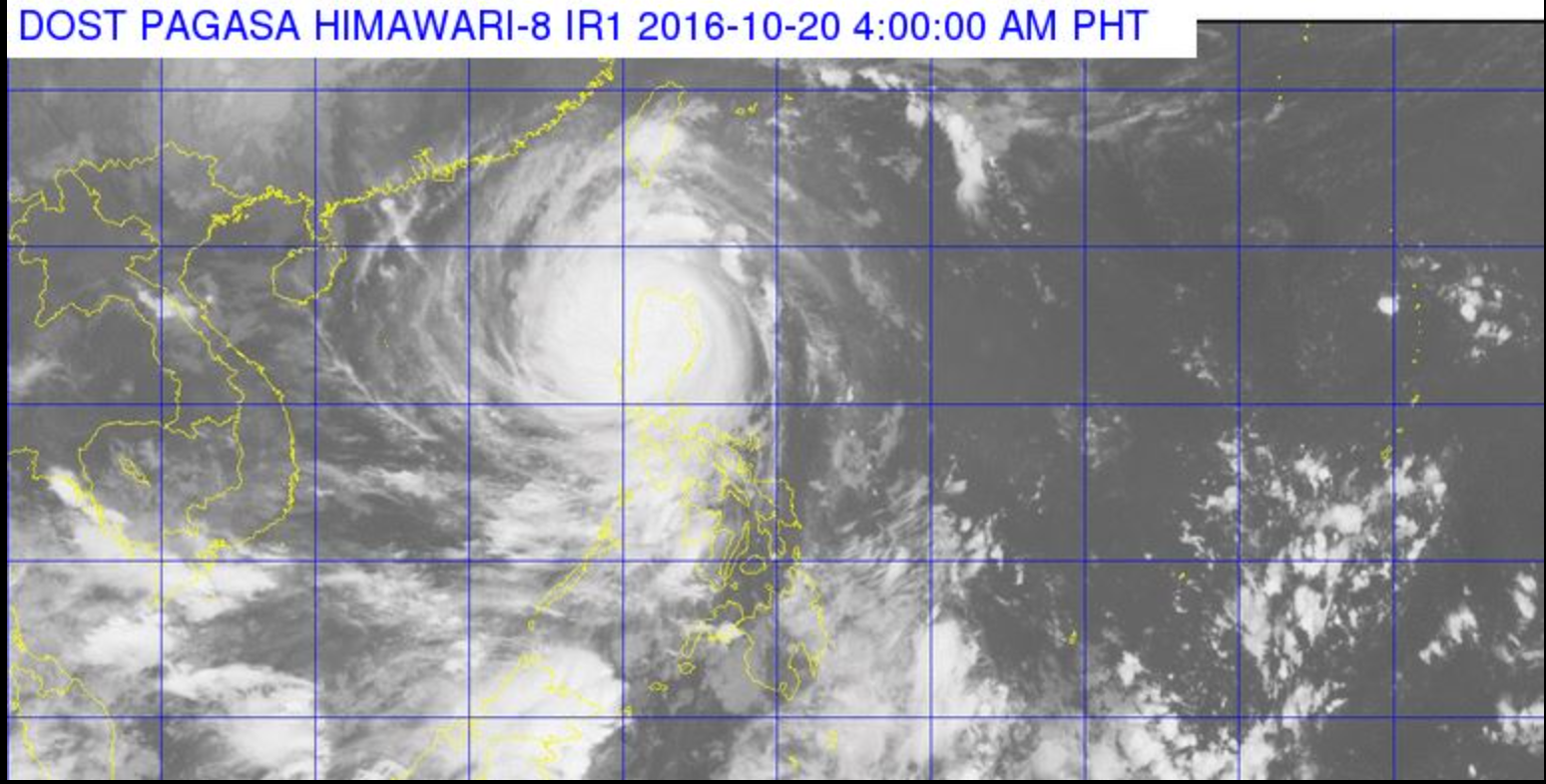
(Eagle News) – Typhoon Lawin has “slightly weakened” early dawn Thursday (October 20) while traversing Apayao province, with its maximum sustained winds down to 215 kilometers per hour from the previous 225 kph, and gusts of 285 kph from the previous 315 kph.
According to PAGASA, the country’s weather bureau, although typhoon Lawin has weakened, it is still a destructive typhoon.
It will exit via Ilocos Norte at around 8 to 10 this morning. By Thursday evening, it will be out of the Philippine Area of Responsibility (PAR)
As of 4 a.m., the eye of typhoon Lawin is in the vicinity of Kabugao, Apayao.
With the slightly weakened typhoon Lawin, the previous public storm warning signal number 5 has been lowered to storm warning signal number 4 in Cagayan, Isabela, Apayao, Abra, Ilocos Norte, Ilocos Sur, Mt. Province, Kalinga, Ifugao and Calayan Group of Islands.
Storm warning signal number 3 is up in La Union, Benguet, Nueva Vizcaya, Quirino and Northern Aurora, while storm warning signal number 2 is up in the Batanes Group of Islands, Pangasinan, Rest of of Aurora, Tarlac, Nueva Ecija and Northern Zambales.
Meanwhile, the rest of Zambales, Bulacan, Bataan, Pampanga, Rizal, Quezon Province including Polillo Island, Cavite, Laguna, Batangas, and Metro Manila remain under storm warning signal number 1.
(Watch continuing special coverage of Eagle News Service at NET 25)


