


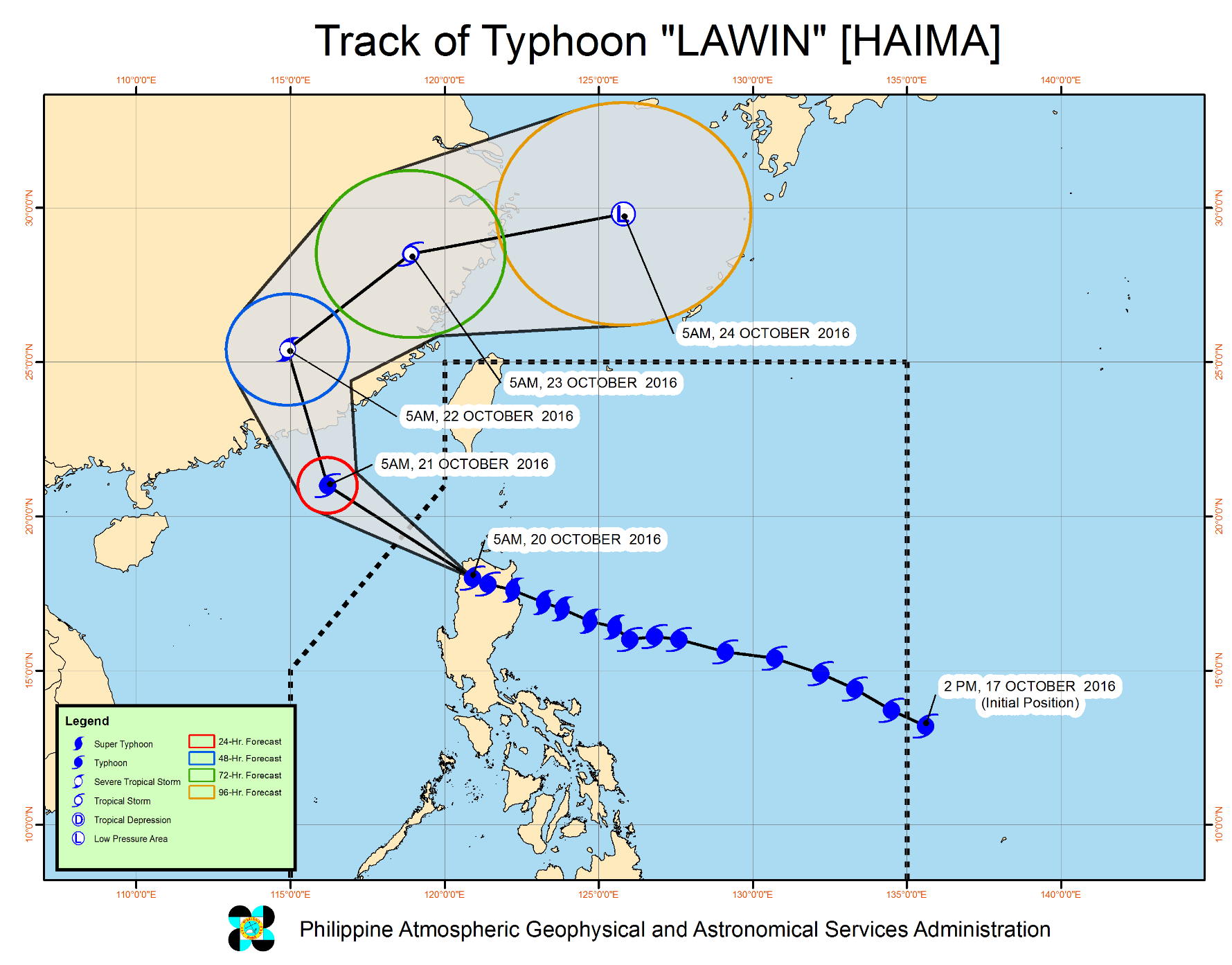
(Eagle News) – Typhoon Lawin again slightly weakened as it further traversed Apayao province, and is expected to exit the Philippine Area of Responsibility (PAR) Thursday night, October 20.
Storm warning signals in Northern Luzon were further reduced in PAGASA’s latest weather bulletin issued at 8 a.m.
As of 7 a.m., the eye of the typhoon was located 40 kilometers northwest of Laoag City, Ilocos Norte. It is forecast to move west northwest at 22 kilometers per hour (kph)
But Lawin is still a powerful typhoon with gusts of up to 230 kph, and an estimated rainfall amount from moderate to heavy within the 700 kilometer diameter of the typhoon.
In its latest weather bulletin, PAGASA, the country’s weather bureau, has placed Ilocos Norte, Cagayan, Isabela, Apayao, Kalinga, Mt. Province, Ifugao, Abra, Ilocos Sur and Calayan Group of Islands under storm warning signal number 3, down from the previous storm signal number 4.
Ten more provinces in Luzon were placed under storm warning signal number 2, namely Batanes Group of Islands, La Union, Benguet, Nueva Vizcaya, Quirino, Pangasinan, Aurora, Tarlac, Nueva Ecija and Northern Zambales.
The rest of Zambales, Bulacan, Bataan and Pampanga remained under storm signal number 1.


