


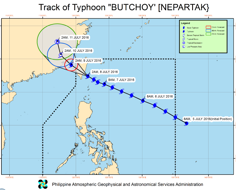
(Eagle News) — Typhoon “BUTCHOY” has slightly weakened and is about to make landfall over Southeast Taiwan.
As of 6 a.m., PAGASA said the typhoon was located 240 kilometers North Northwest of Itbayat, Batanes. It has maximum sustained winds of 195 kph near the center
and gustiness of up to 230 kph, and is forecast to move West Northwest at 15 kph.
By Saturday morning (July 8), “Butchoy” or typhoon Nepartak is forecast to be outside the Philippine Area of Responsibility.
As of PAGASA’s 5 a.m. weather bulletin, public storm warning signal number two is still hoisted over the Batanes group of islands, while public storm warning signal number one is raised over the Babuyan Group of Islands.
But because typhoon Butchoy has enhanced the southwest monsoon, PAGASA has issued the following rainfall warnings: red warning level in Zambales and Bataan, which means serious flooding is expected in these areas; orange warning level in Batangas and Cavite (flooding is threatening); and yellow warning level in Metro Manila and Pampanga (possible flooding in low level areas)


