


The weather state bureau on its Tuesday forecast said that cloudy skies with moderate to occasionally heavy rains and isolated thunderstorms will be experienced over Metro Manila, Ilocos region, Cordillera Administrative region (CAR), CALABARZON and over the Provinces of Zambales, Bataan and Mindoro.
The Philippine Atmospheric Geophysical Astronomical Services Administration (PAGASA) also said that cloudy skies with light to moderate rains and thunderstorms will prevail over Visayas, Zamboanga Peninsula and the rest of Luzon. Partly cloudy to cloudy skies with isolated rainshowers or thunderstorms is expected over the rest of Mindanao.
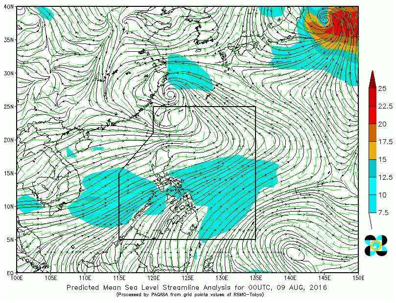
At 4:00 AM today, PAGASA said that a Low Pressure Area (LPA) was estimated based on all available data at 1,200 km east of Aparri, Cagayan (18.6°N, 132.8°E). Southwest monsoon affecting Luzon and Visayas.
Meanwhile, moderate to strong winds blowing from the southwest will prevail throughout the entire archipelago and the coastal waters will be moderate to rough.


