


(Eagle News)–Signal No. 1 has been hoisted over several areas as “Chedeng” slowed down while maintaining its strength.
In its recent advisory, the Philippine Atmospheric Geophysical and Astronomical Services Administration said Davao Oriental, Compostela Valley, Davao del Sur, Davao City, Davao Occidental, the southern part of Davao del Norte including Samal Island, the eastern part of North Cotabato and eastern part of Sarangani are now under Signal No. 1, as the tropical depression was expected to make landfall over the eastern coast of Davao Oriental tomorrow morning, March 19.
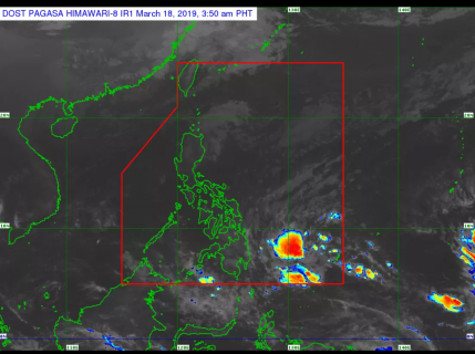
According to PAGASA, the center of “Chedeng” was seen 650 km east of Davao City, packing maximum sustained winds of up to 45 km/h near the center and gustiness of up to 60 km/h as it moves westward at 15 km/h.
PAGASA said scattered to at times widespread moderate to heavy rains will prevail over Surigao del Sur, Agusan del Sur, Davao Oriental, Compostela Valley, and Davao del Norte today, March 18, and in most parts of Mindanao tomorrow, March 19.
“The disaster risk reduction and management offices concerned and residents of these areas, especially those living in areas identified to be at high risk of flooding or landslide, are advised to undertake necessary preparations and continue monitoring for updates,” PAGASA said.
It said those with small seacraft are advised not to venture out over the eastern seaboards of Visayas and Mindanao, as well as the seaboards of areas under Tropical Cyclone Warning Signal.


