


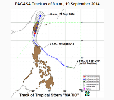
MANILA, Philippines (ENS) — Tropical Storm “MARIO” has maintained its strength and has made landfall over the northern tip of Cagayan.
As of 10 a.m, “Mario” was spotted at 64 kilometers north northeast of Tuguegarao City, with maximum winds of 85 kilometers per hour near the center and gustiness of up to 100 kilometers per hour. It is forecast to move west northwest at 22 kilometers per hour.
PAGASA said that by Saturday morning, “Mario” will be 190 northwest of Itbayat, Batanes. It is forecast to be outside the Philippine Area of Responsibility (PAR) by Sunday morning.
Signal number two is still in effect in Cagayan, including Calayan, Babuyan and Batanes Group of Islands, Isabela, Kalinga, Apayao, Mt. Province, Abra and Ilocos Norte, with winds of 61-100 kph is expected in the next 24 hrs.
Signal number one is hoisted over Aurora, Quirino, Nueva Vizcaya, Ifugao, Benguet, Ilocos Sur, and La Union with winds of 30-60 kph expected in the next 36 hours.
Residents in low lying and mountainous areas under signal #2 and #1 are alerted against possible flashfloods and landslides.
Estimated rainfall amount is from 7 – 20 mm per hour (moderate – intense) within the 350 km diameter of the Tropical Storm.
The combined effect of Southwest Monsoon and TS “MARIO” will bring moderate to heavy rains and thunderstorms in Metro Manila and the rest of Luzon which may trigger flashfloods and landslides, according to PAGASA’s latest weather forecast. (Eagle News Service)


