


(Eagle News)–The low pressure area off Batanes has developed into a tropical depression.
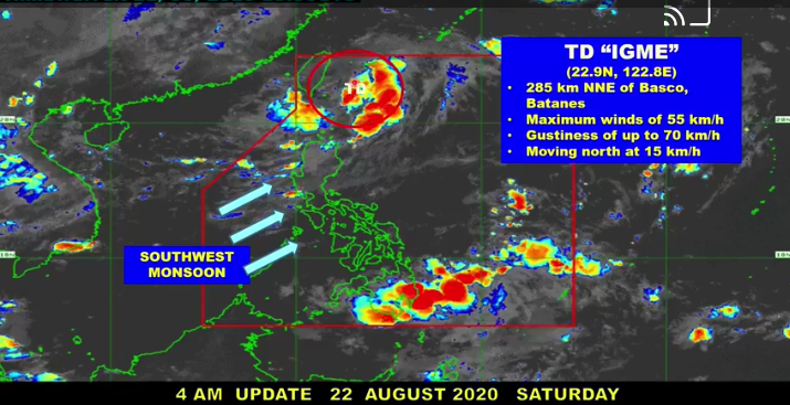
The Philippine Atmospheric Geophysical and Astronomical Services Administration’s Benison Estareja said as of 3 a.m. today, TD “Igme” was located 285 kilometers north northeast of Basco, packing maximum sustained winds of 57 kilometers per hour, and gustiness of 70 kph.
It is so far not directly affecting the country as it moves northwards at 15 kph, but is affecting the southwest monsoon, bringing rains in parts of Luzon.
A cloud cluster spotted over Mindanao will bring rains over parts of the island group, but Estareja said the chances this would turn into a weather disturbance were low.
Estareja said “Igme” was expected to intensify into a tropical storm early Sunday but not before leaving the Philippine Area of Responsibility either this afternoon or tonight.
No tropical cyclone wind signal has been hoisted over any part of the country so far, but intermittent gusts may be experienced over Batanes and the Babuyan Group of Islands as “Igme” enhances the southwest monsoon, Estareja said.
A gale warning has been raised over Batanes and the Babuyan Group of Islands, with waves of up to 4 meters in height expected.
Strong waves are also expected in the western seaboards of Luzon.


