


(Eagle News) — “Igme” has intensified into a severe tropical storm.
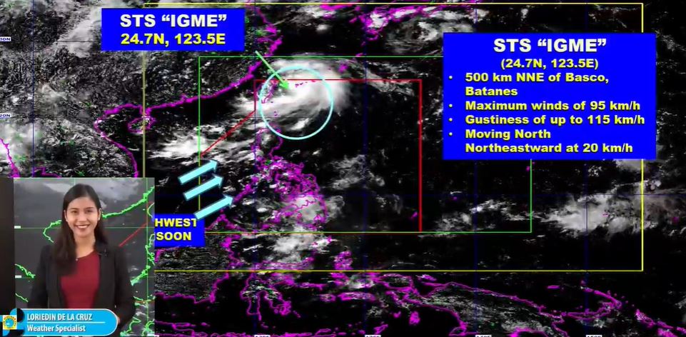
But the Philippine Atmospheric Geophysical and Astronomical Services Administration’s Loriedin Dela Cruz said the weather disturbance situated 500 kilometers north northeast of Basco, Batanes no longer has any direct effect on the country, as it moves north northeast at 20 kilometers per hour and is expected to exit the Philippine Area of Responsibility tonight.
So far, the center of “Igme” is packing maximum sustained winds of 95 kilometers per hour near the center and gustiness of up to 115 kilometers per hour.
Although no tropical cyclone wind signal is in effect in any part of the country, Dela Cruz said cloudy skies with scattered rainshowers and thunderstorms are expected over Ilocos region, the Cordillera Administrative Region, Zambales, Bataan, Batanes and the Babuyag Group of Islands due to the southwest monsoon.
She said Mindanao will have generally good weather with some rains due to thunderstorms.
Metro Manila and the rest of the country, on the other hand, will have partly cloudy to cloudy skies with isolated rainshowers.
Dela Cruz said a gale warning has been raised over Batanes, which means small vessels are advised not to go out to sea.
Strong waves are also expected in the waters of western and central Luzon.


