


 MANILA, August 8 (PNA) — Typhoon “Hanna” will bring rough to very rough sea conditions to Batanes said the Philippine Atmospheric Geophysical and Astronomical Services Administration (PAGASA) on Saturday.
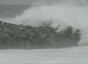
“Stormy weather with rough to very rough seas will prevail over Batanes while rains with gusty winds over northern Cagayan including Calayan and Babuyan group of islands,” PAGASA said on its 5 a.m. weather bulletin Saturday.
PAGASA noted that typhoon Hanna was located 380 km north of Itbayat, Batanes (24.2°N, 122.1°E) with maximum sustained winds of 175 kilometers per hour (kph) near the center and gustiness of up to 210 kph.
PAGASA added Typhoon “Hanna” is forecast to move west northwest at 20 kph.
The estimated rainfall within the 750-kilometer (km) diameter of the typhoon will be moderate to heavy.
Public storm warning signal no. 2 remains hoisted over Batanes province, including Itbayat, which will experience 61-120 kph winds expected in 24 hours. It warned the public against 4.1- to 14-meter storm surges along the coastal areas.
PAGASA also issued storm warning signal no. 1 in the Calayan and Babuyan Group of Islands and northern Cagayan which will experience 30-60 kph winds within 36 hours. These areas will experience storm surges of 1.25-4.0 meters.
PAGASA cited that typhoon Hanna will be outside the Philippine Area of Responsibility (PAR), estimated at 690 km north northwest of Itbayat, Batanes within 24 hours.
By Monday morning, it is estimated to be 1,210 km northwest of Itbayat, Batanes.
PAGASA said it also estimates the weather disturbance to be 1,500 km north northwest of Itbayat, Batanes by Tuesday morning.
Meanwhile, PAGASA said the southwest monsoon might trigger flashfloods and landslides in Western Visayas and the provinces of Mindoro, Ilocos Norte and Apayao.
According to PAGASA, other areas in Luzon and Visayas, including Metro Manila, will experience light to moderate rains and isolated thunderstorms.
For Mindanao, PAGASA said it will experience partly cloudy to cloudy skies along with isolated thunderstorms.
PAGASA added the country will have moderate to strong winds coming from the Southwest.
PAGASA also mentioned the coastal waters over the rest of the archipelago will be moderate to rough.
The state-run weather bureau has also issued a gale warning over the Northern Luzon seaboards, western and southern seaboards of Southern Luzon including the seaboards of Panay Island, eastern seaboard of Central and Southern Luzon and the eastern seaboard of Visayas.
(PNA)
JBP/JLD


