


(Eagle News) — Signal No. 4 is now up over four areas as Typhoon “Ompong” moved closer to Isabela and Cagayan on Friday night.
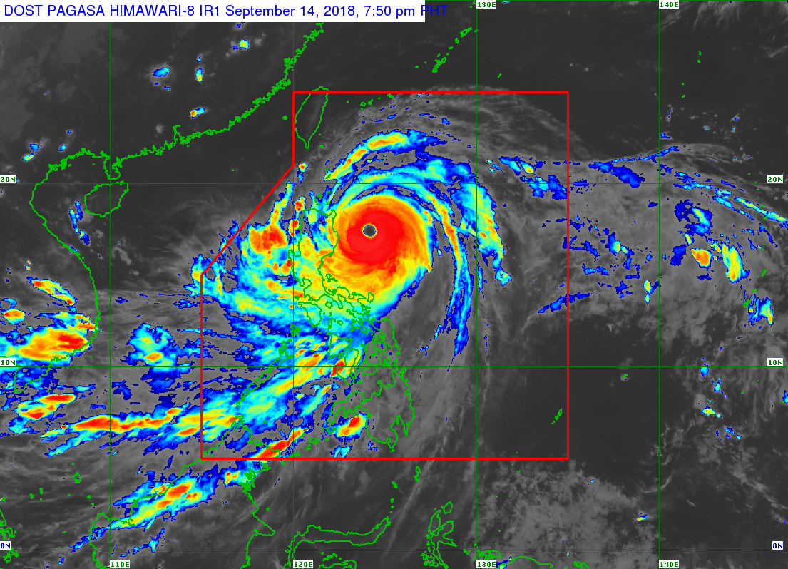
As of 7 p.m., the Philippine Atmospheric Geophysical and Astronomical Services Administration said the eye of “Ompong” was located 260 kilometers east northeast of Casiguran, Aurora.
“Ompong” is packing maximum sustained winds of 205 kilometers per hour near the center and gustiness of up to 255 kilometers per hour.
It maintained its speed at 30 kilometers per hour as it moved northwest, and is expected to make landfall over the Cagayan-Isabela area from 1 to 3 a.m.
According to PAGASA, Cagayan, Northern Isabela, Apayao and Abra will experience stormy weather as areas under Signal No. 4.
PAGASA said in Isabela, waves reaching 1 to 2 meters may be formed, while in Cagayan including the Babuyan Group of Islands and the northern part of northern Luzon, there may be waves reaching 3 to 6 meters in height.
PAGASA said the western coast of northern Luzon may also experience waves reaching two to three meters in height.
PAGASA said the areas under Signal No. 3–Batanes including the Babuyan Group of Islands, Ilocos Norte, Ilocos Sur, La Union, Kalinga, Mountain Province, Benguet, Ifugao, Nueva Vizcaya, Quirino and Southern Isabela—and those under Signal No. 2–La Union, Pangasinan, Tarlac, Northern Quezon including Polillo Island, Nueva Ecija, Southern Aurora, Zambales, Pampanga and Bulacan–will also experience stormy weather.
Signal No. 1 is up over Bataan, Rizal, Northern Occidental Mindoro including Lubang Island, Metro Manila, Cavite, Batangas, Laguna and the rest of Quezon, northern Oriental Mindoro, Camarines Sur, Catanduanes, Albay, Sorsogon, Masbate, Marinduque, Camarines Norte, Burias and Ticao Islands., which means very strong winds and occasional rains will be experienced there.
Occasional moderate rains to heavy rains are also forecast in the Visayas, and scattered light to moderate to at times heavy rains are forecast in Palawan, Northern Mindanao and Caraga, as a result of an enhanced southwest monsoon.
PAGASA said if “Ompong” doesn’t change its speed, it may be out of the Philippine Area of Responsibility by Saturday evening.


