


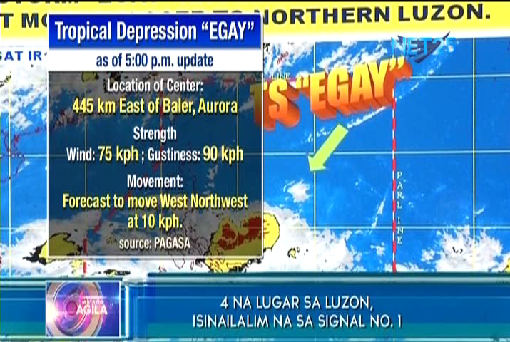
UPDATED 6:30 p..m. MANILA, Philippines, July 3 (Eagle News) — The weather bureau said on its Friday forecast that the tropical storm “Egay” has slightly intensified and slowed down while it continued to move closer to Northern Luzon.
Egay has maximum sustained winds of 75 kilometers per hour near the center and gustiness of up to 90 kilometers per hour. It is forecast to move west northwest at 10 kph.
Earlier, the Philippine Atmospheric, Geophysical and Astronomical Services Administration (PAGASA) said tropical storm “Egay” will landfall in the province of Batanes by Sunday evening or Monday morning.
But as of 6 p.m., PAGASA forecaster Aldczar Aurelio told NET 25 the storm might landfall much later, possibly on Wednesday as “Egay” slowed down.

By Saturday morning, Egay is expected to be 210 km East of Casiguran Aurora, and by Sunday morning, it is estimated to be 130 km East Northeast of Tuguegarao City, Cagayan. On Monday morning, it will be in the vicinity of Calayan and Babuyan group of islands. On Tuesday, it will be 190 km Northwest of Basco, Batanes. And by Wednesday morning, it is forecast to be 385 km North Northwest of Basco, Batanes.
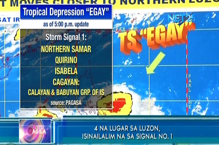
At least four provinces were placed under storm signal number 1. These are Northern Aurora, Quirino, Isabela, and Cagayan including Calayan and the Babuyan group of Islands.
Meanwhile, another tropical storm is expected to landfall in the Philippine area of responsibility (PAR) once tropical storm Egay leaves the country. The said weather disturbance will be named “Falcon” once it enters PAR. (Eagle News Service)


