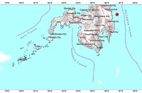
(Eagle News)–“Chedeng” maintained its strength on Monday evening as it moved toward the southern Davao Oriental area, the Philippine Atmospheric Geophysical and Astronomical Services Administration said.
According to PAGASA, as of 7 p.m., the center of the tropical depression was located 205 kilometers east southeast of Davao City or 260 kilometers east of General Santos City.
It is packing maximum sustained winds of up to 45 kilometers per hour near the center and gustiness of up to 60 kilometers per hour as it moved westward at 20 kilometers per hour.
“Chedeng” may make landfall over the southeastern coast of Davao Oriental and / or the eastern coast of Davao Occidental tomorrow early morning, PAGASA said.
It is expected to weaken into a Low Pressure Area after landfall.
Signal No. 1 has been hoisted over Davao Oriental, Compostela Valley, Davao del Sur, Davao City, General Santos City, Davao Occidental, the southern portion of Davao del Norte including Samal Island, eastern portion of North Cotabato, eastern portion of South Cotabato, eastern portion of Sarangani, and the eastern portion of Sultan Kudarat.
Scattered to at times widespread moderate to heavy rains will prevail over Caraga and Davao Regions, especially over Surigao del Sur, Agusan del Sur, Davao Oriental, Davao del Norte and Compostela Valley tonight.
Tomorrow, scattered to at times widespread moderate to heavy rains may be experienced over most parts of Mindanao, especially over portions of Davao Region, SOCCSKSARGEN, Bangsamoro, and Zamboanga Peninsula, PAGASA said.
Those with small seacrafts are advised not to venture out over the eastern seaboards of Visayas and Mindanao, as well as the seaboards of areas under Tropical Cyclone Warning Signals.


