


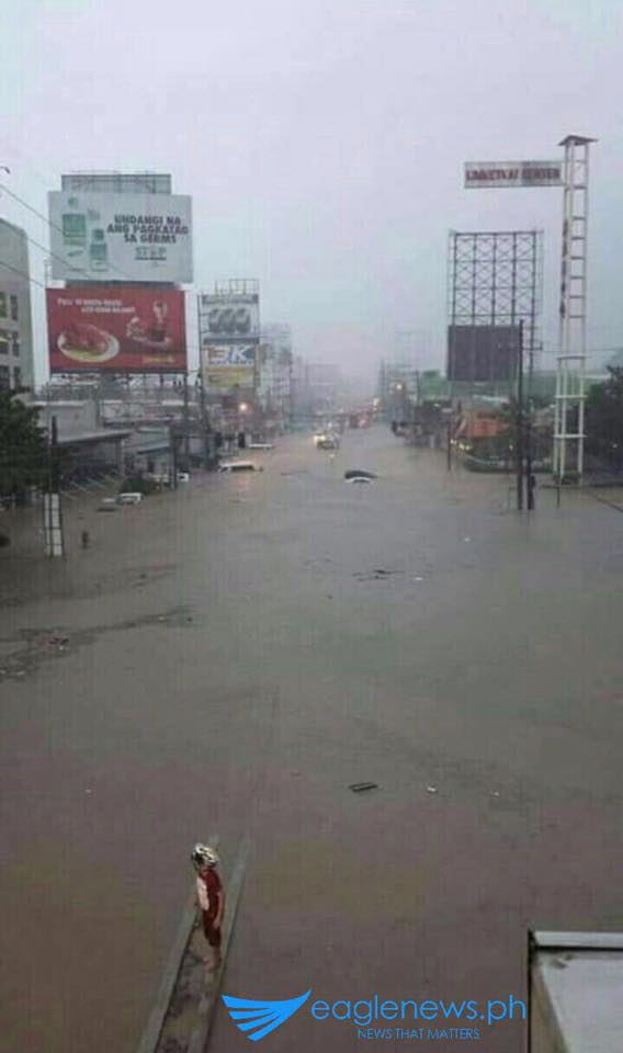

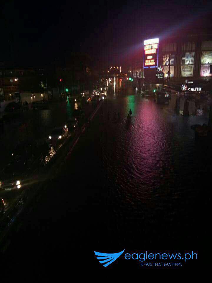
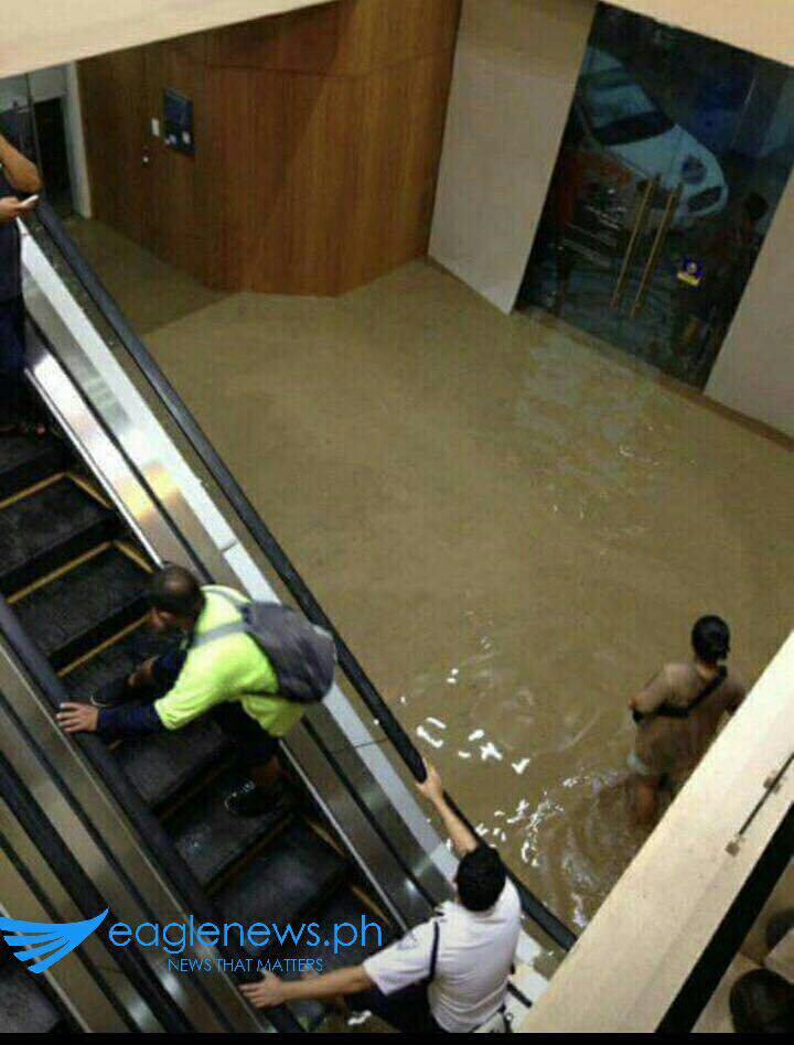
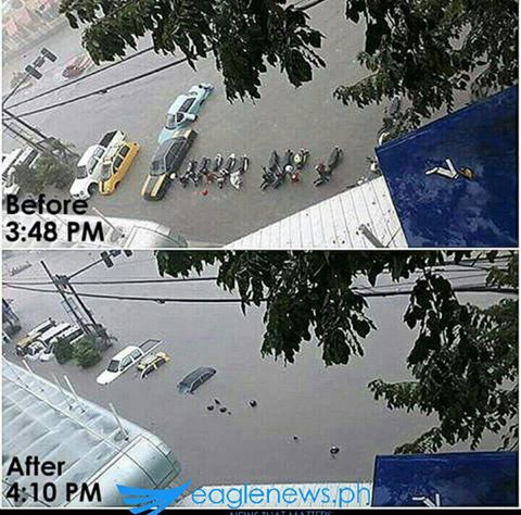
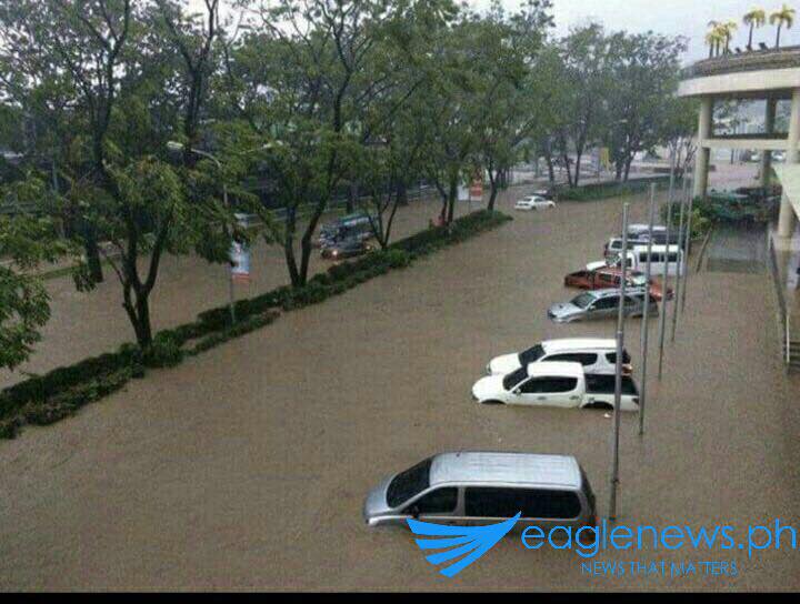
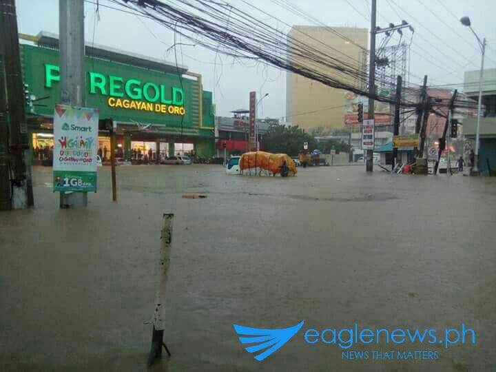
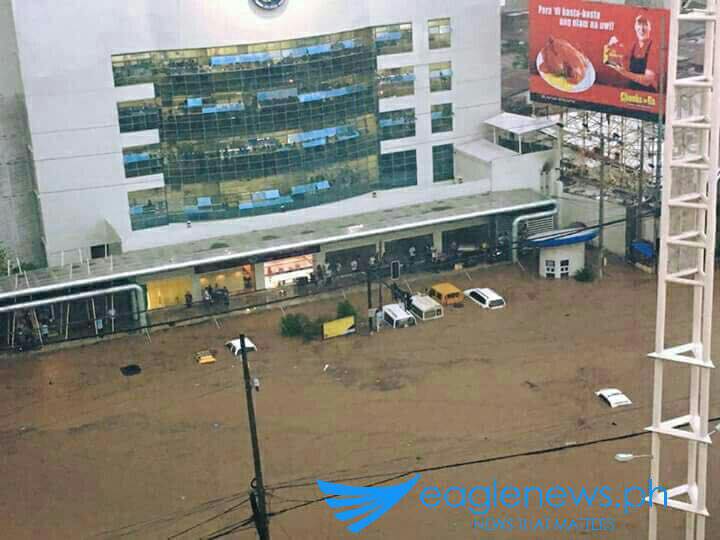
QUEZON CITY, Philippines (Eagle News) — Cagayan de Oro was affected by heavy flooding on Monday, January 16, because of two weather systems affecting the area – the tail end of a cold front and a low pressure area – that affected thousands of residents and leaving hundreds of people stranded.
Photos sent to Eagle News Service showed the sudden flooding that submerged vehicles parked along the streets.
But the weather bureau warned that flashfloods could still be experienced in Eastern Visayas, Caraga, Northern Mindanao, Zamboanga Peninsula and the province of Bohol.
From 11 in the morning until 7 in the evening, the rains were non-stop on Monday, according to Cagayan de Oro mayor Oscar Moreno.
The weather bureau on Tuesday, January 17 said that the cloudy skies with moderate to occasionally heavy rains and thunderstorms may trigger these flashfloods and landslides.
The Philippine Atmospheric Geophysical and Astronomical Services Administration (PAGASA) said that a cloudy sky with light to moderate rains and isolated thunderstorms is expected over the rest of Visayas and of Mindanao on Tuesday.
Cloudy Skies with light rains will prevail over Cagayan Valley, Mimaropa, Bicol Region and provinces of Aurora and Quezon. Partly cloudy to cloudy skies with isolated light rains will prevail over Metro Manila and the rest of Luzon.
Meanwhile, moderate to strong winds blowing from the northeast will prevail over Luzon, Visayas and Caraga. The coastal waters over these areas will be moderate to rough. Elsewhere, winds will be light to moderate coming from the northeast to north with slight to moderate seas.
PAGASA in its weather forecast issued at 4:00 AM today said that the Low Pressure Area (LPA) was estimated based on all available data at 70 km East Northeast of Zamboanga City, Zamboanga del Sur (7.2N, 122.6E).
The country’s weather bureau also said that the tail-end of a cold front is affecting the Visayas.


