


MANILA, March 21 (PNA) — Eight more provinces in Mindanao are now under public storm warning signal no. 1 as tropical depression “Caloy” has slightly accelerated as it moves closer to Surigao del Sur and Davao Oriental area, the Philippine Atmospheric, Geophysical and Astronomical Services Administration (PAGASA) said on Friday.
Earlier, PAGASA raised public storm warning no. 1 in four other provinces in Mindanao.
In an interview, PAGASA weather forecaster Gener Quitlong said as of 11 a.m., the center of tropical depression “Caloy” was located at 325 km east northeast of Davao City (7.9°N, 128.7°E) packed maximum sustained winds of 45 kph.
Quitlong said “Caloy” is forecast to move west and gains speed at 11 kph.
Citing numerical models with its movement, he said “Caloy” may make landfall in Davao Oriental or Surigao del Sur by Friday evening or early Saturday morning.
He said that public storm warning signal no. 1 (Winds of 30-60 kph expected in at least 36 hours) was now also hoisted over Compostela Valley, Northern part of Davao del Sur including Davao City, Surigao del Norte, Agusan del Norte, North Cotabato, Bukidnon and Misamis Oriental.
Earlier placed under storm signal no. 1 were Surigao del Sur, Agusan del Sur, Davao del Norte and Davao Oriental.
According to PAGASA, the potential impact of winds is the following:
•Twigs and branches of trees may be broken;
•Some banana plants may tilt or land flat on the ground;
•Rice in flowering stage may suffer significant damage;
•Some nipa and cogon houses may be partially unroofed; and
•Travel of small seacrafts and fishing boats is risky
PAGASA added that residents living in low-lying and mountainous areas under public storm warning signal no. 1 are alerted against possible flashfloods and landslides.
He said estimated rainfall amount within the 300-km diameter of the cyclone is from five to 15 millimeters per hour, which is classified as “moderate to heavy.”
If “Caloy” made a landfall, he said the cyclone is expected to weaken into low pressure area. The other scenario, he said “Caloy” may intensify into tropical storm since it is still in the sea.
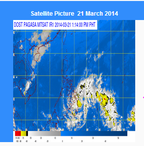
Because of the tropical depression, Quitlong said most parts of the Visayas and Mindanao will experience “cloudy skies” with light to moderate rains until weekend.
He noted that the rest of Luzon, including Metro Manila, will not be affected by the cyclone and will continue to experience fair weather aside from isolated light rains due to the northeast monsoon.
Meanwhile, PAGASA said the cyclone is forecast to be at 95 km Northeast of Davao City by Saturday morning.
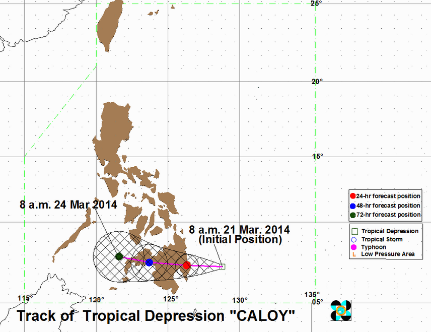
By Sunday morning, it is expected to be at 70 km North of Cotabato City and at 150 km Northwest of Zamboanga City on Monday morning.
PAGASA also said that fishing boats and other small seacrafts are advised not to venture out into the northern seaboard of Northern Luzon and the eastern seaboards of Northern and Central Luzon due to the Northeast Monsoon. (Philippine News Agency)


