


(Eagle News)–The northeasterly surface windflow is affecting Northern Luzon.
The Philippine Atmospheric Geophysical and Astronomical Services Administration said the disturbance was apart from Tropical Storm “Siony,” which has prompted the lifting of Signal No. 1 over Cagayan and the Babuyan Islands.
PAGASA said Cagayan Valley and Cordillera Administrative Region will have cloudy skies with light rains as a result, while the rest of Luzon will have partly cloudy to cloudy skies with isolated light rains.
Metro Manila, CALABARZON, Central Luzon and Bicol Region, on the other hand, will have cloudy skies with scattered rainshowers and thunderstorms, this time due to the trough of “Siony.”
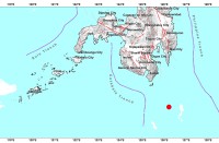
“Siony” is so far located 700 kilometers east of Basco, Batanes, packing maximum sustained winds of 85 kph near the center, and gustiness of up to 105 kph.
It is moving south southwest.
PAGASA said flash floods or landslides due to scattered light to moderate to at times heavy rains are possible.
Partly cloudy skies to at times cloudy with rainshowers or thunderstorms are expected over the rest of the country due to localized thunderstorms.
Northern Luzon and the eastern section of Central and Southern Luzon will have moderate to strong winds and moderate to rough coastal waters.


