


(Courtesy PHIVOLCS)
(Eagle News) – The Philippine Institute of Volcanology and Seismology (PHIVOLCS) has monitored both volcanic and tectonic quakes in Batangas as Taal Volcano continued to increase its volcanic activity Sunday night, Jan. 12.
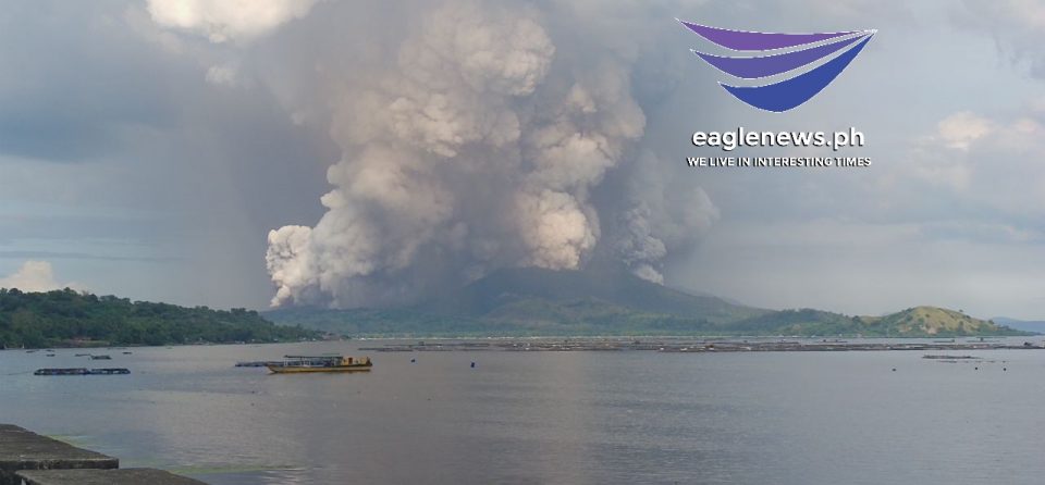
Taal, which had its last major eruption in 1977, again had increased volcanic activity that prompted PHIVOLCS to raise alert level 4, which means “imminent hazardous eruption” within hours or days.
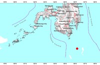
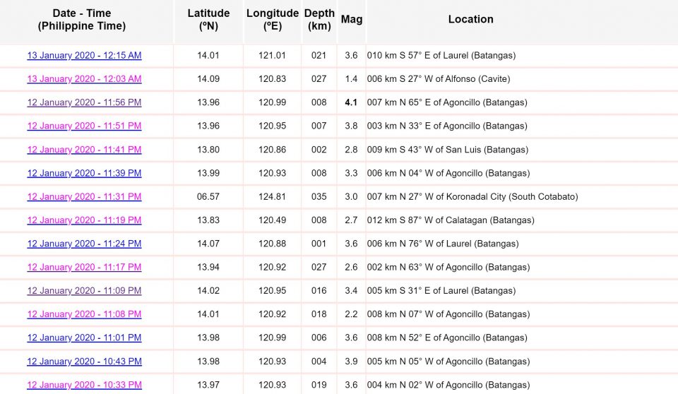
PHIVOLCS recorded a series of volcanic and tectonic quakes in Batangas, as well as in Tagaytay City in Cavite province starting Sunday afternoon, Jan. 12.
Maricel Capa, PHIVOLCS senior science research specialist, said these quakes are all related to the ongoing increasing volcanic activity of Taal.
But she said that the other tectonic quakes recorded in other regions in the country, including the most recent magnitude 5 quake in Surigao del Sur, in Mindanao, had nothing to do with the Taal volcano’s activity.
If Taal volcano goes into alert level 5, this means that hazardous magmatic eruption is already taking place.
This is particularly dangerous as magmatic eruption is “characterized by explosive production of tall ash-laden eruption columns, or by massive collapses of summit lava dome,” according to PHIVOLCS.
If this happens, there will be “generation of deadly pyroclastic flows, surges and/or lateral blasts and widespread ashfall,” it said in the description of the various volcanic alert levels.
Such a life-threatening eruption could produce “volcanic hazards that endanger communities,” PHIVOLCS said.
Phivolcs has already placed Taal under Alert Level 4 and strongly reiterated the “total evacuation of Taal Volcano Island and additional evacuation of areas at high risk to pyroclastic density currents and volcanic tsunami within a 14-kilometer radius from Taal Main Crater.”


