


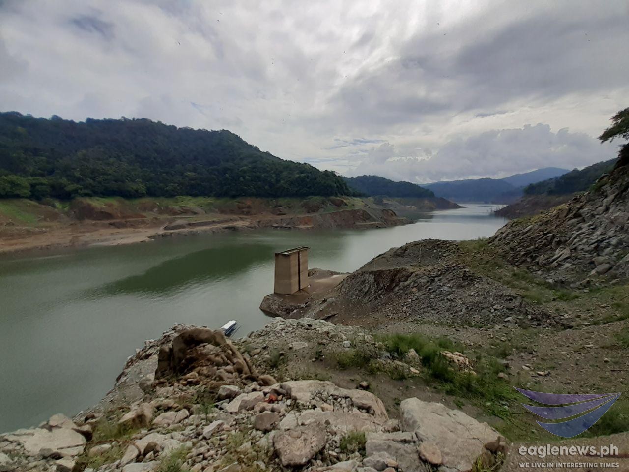
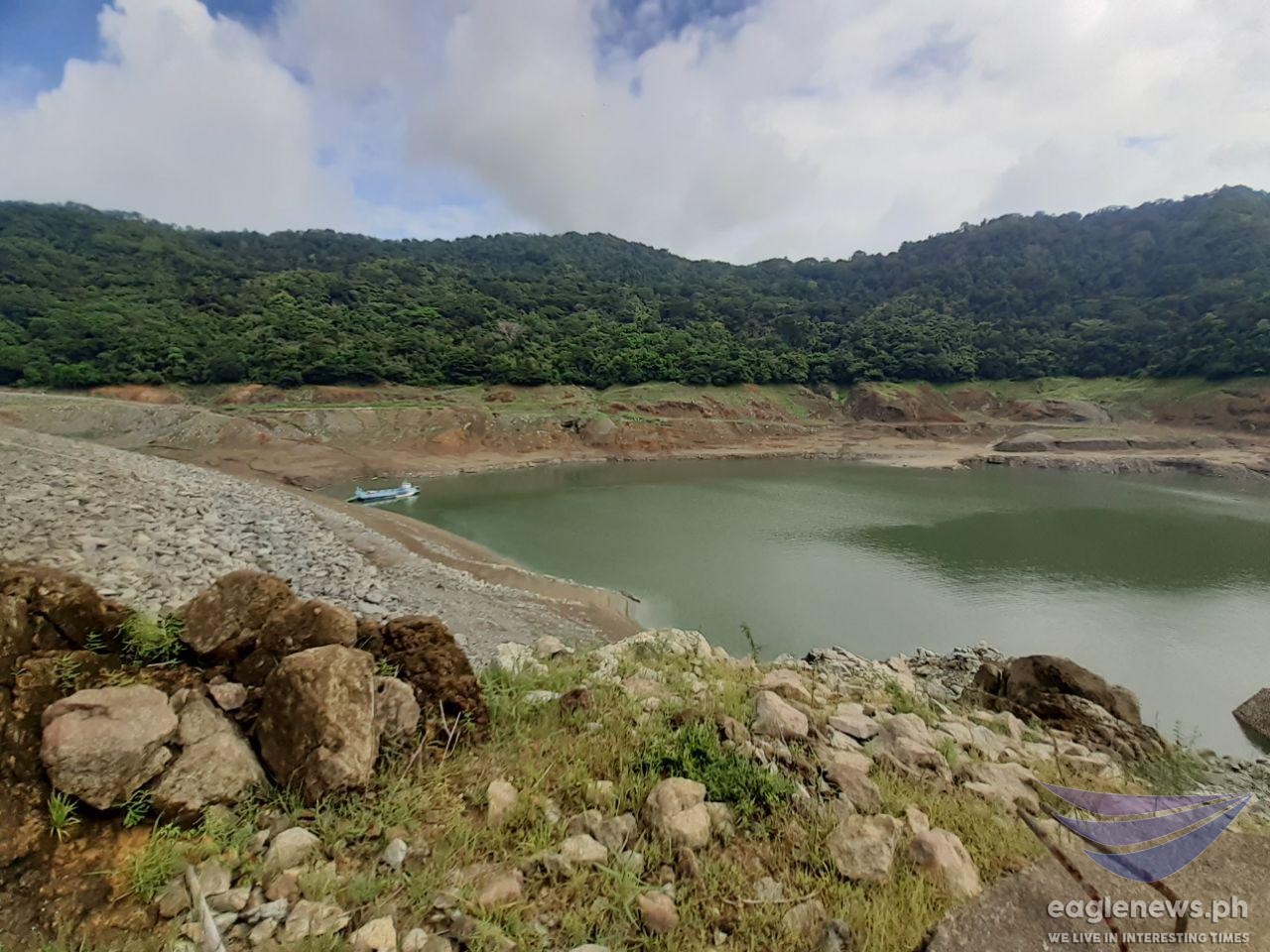
(Eagle News) — Amid a dramatic backdrop of vast cloudy skies, Angat Dam in Bulacan — one of the main sources of water for millions of Metro Manila residents — can be seen here in these photos with its exposed bare embankment that had previously submerged in water.
Located 38 kilometers north of Metro Manila, the Angat Reservoir and Dam supplies 98 percent of Metro Manila’s Water needs with a storage capacity of about 850 million cubic meters.
The rockfill dam with a spillway equipped with three gates at a spilling level of 212 meters, is located at the Angat River in San Lorenzo, Norzagaray, Bulacan.
Constructed from 1964 to 1967, the Angat Reservoir and Dam have been operational since 1968.
The facilities supply the domestic and industrial water requirements of Metro Manila residents; provide irrigation to about 31,000 hectares of land in 20 municipalities and towns in Pampanga and Bulacan; generate hydroelectric power to feed the Luzon Grid; and reduce flooding to downstream towns and villages.
As of Friday, June 28, Angat Dam’s water level is still below the critical level of 160 meters, at a low of 158.02 meters.
Its lowest level was recorded at 157.56 meters which was recorded on July 18, 2010 when the Central Pacific experienced the so-called “warm pool El Niño”
The National Water Resources Board (NWRB) said that, without much rainfall flowing to its watershed, the dam is expected to breach this lowest record level by weekend.
Angat Dam’s principal river, Angat River, originates from the Sierra Madre Mountains, and has three major tributaries namely the Talaguio, Catmon and Matulid Rivers.
The Angat Watershed, with an area of about 568 square kilometers, receives an average annual rainfall of about 4,200 millimeters.
(Photos by Earlo Bringas, Eagle News Service)


