


To further weaken as it traverses Southern Luzon tonight
(Eagle News) – Typhoon Rolly (Goni) is heading towards the southeastern coast of Batangas with “destructive winds and intense rainfall” that will prevail over Batangas and Cavite in the next 12 hours.
PAGASA, in its 5 p.m. bulletin, said this is a “particularly dangerous situation for these areas.”
But typhoon “Rolly” is “forecast to exit the mainland Luzon landmass and emerge over the West Philippine Sea tonight.“
“During its traverse of Southern Luzon, ‘ROLLY’ is forecast to weaken but will emerge as a typhoon over the West Philippine Sea,” PAGASA said.
PAGASA also said that Typhoon Rolly is “forecast to weaken” as it traverses Southern Luzon, but “will emerge as a typhoon over the West Philippine Sea.”
It said that the typhoon is “forecast to exit the mainland Luzon landmass and emerge over the West Philippine Sea tonight.”
-Maximum sustained winds down to 165 kph, gusts up to 230 kph-
Tropical Cyclone Wind Signal no. 4 has been lowered to Signal no. 3, in PAGASA’s 5 p.m. bulletin as the typhoon’s maximum sustained winds weakened.
PAGASA said that the typhoon has “maximum sustained winds of 165 km/h near the center and gustiness of up to 230 km/h” in its 5 p.m. bulletin, and is moving Westward at 25 km/h.
This is significantly weaker than its maximum sustained winds of 225 kph and gusts of up to 310 kph early this morning.
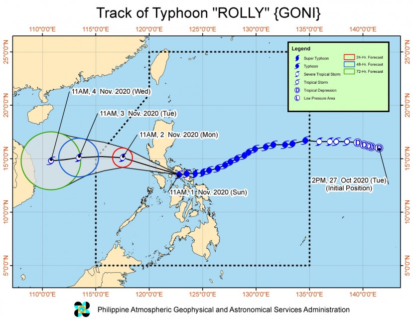
As of 4 p.m. today, the eye of Typhoon “ROLLY” was located based on all available data at 50 km South Southwest of Tayabas, Quezon(13.6°N, 121.4°E).
-Areas under Signal no. 3-
Signal No. 3 is raised in the following areas: The southern portion of Zambales (San Marcelino, San Narciso, Subic, Olongapo City, Castillejos, San Antonio), Bataan, the southern portion of Pampanga (Floridablanca, Guagua, Minalin, Apalit, Macabebe, Masantol, Sasmuan, Lubao), the southern portion of Bulacan (Baliuag, Bustos, Angat, Norzagaray, San Jose del Monte City, Santa Maria, Pandi, Plaridel, Pulilan, Calumpit, Malolos City, Guiguinto, Balagtas, Bocaue, Marilao, Meycauayan City, Obando, Bulacan, Paombong, Hagonoy), Rizal, Quezon including Polillo Islands, Metro Manila, Cavite, Laguna, Batangas, Marinduque, the northwestern portion of Occidental Mindoro (Santa Cruz, Mamburao, Paluan, Abra de Ilog) including Lubang Island, and the northern portion of Oriental Mindoro (Puerto Galera, San Teodoro, Baco, Calapan City, Naujan, Victoria, Naujan Lake, Pola, Socorro)
There will be 121-170 km/h winds to prevail in these areas in the next 18 hours.
-Areas under Signal no. 2-
Signal No. 2 is raised in the following areas: The rest of Zambales, the rest of Pampanga, the rest of Bulacan, the southern portion of Tarlac (Concepcion, Capas, Bamban), the rest of Occidental Mindoro, the rest of Oriental Mindoro, and the southern portion of Nueva Ecija (General Tinio, Gapan City, Peñaranda, San Leonardo, Jaen, San Isidro, Cabiao, San Antonio)
These areas will have 61-120 km/h winds in the next 24 hours.
-Areas under Signal no. 1-
Signal No. 1 is raised in these areas: Mainland Cagayan, Isabela, Apayao, Kalinga, Mountain Province, Ifugao, Abra, Ilocos Norte, Ilocos Sur, La Union, Benguet, Nueva Vizcaya, Quirino, the rest of Aurora, the rest of Nueva Ecija, the rest of Tarlac, Camarines Sur, Camarines Norte, Burias Island, Romblon, and Calamian Islands
These areas will have winds between 30 to 60 km/hr in 36 hours.
(Eagle News Service)


