


(Eagle News) — Super typhoon “Mangkhut” has further intensified as it continued to move westward towards Luzon, as forecasters predicted that the super typhoon could reach wind speeds nearing the intensity of supertyphoon Haiyan upon its expected entry into the country by tomorrow evening, Wednesday, Sept. 12.
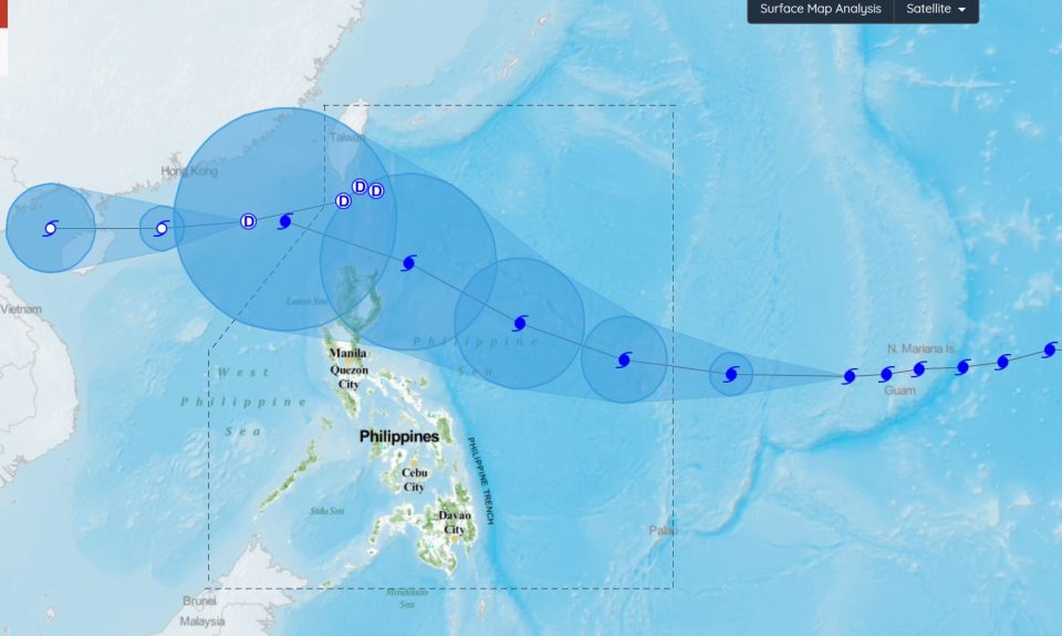
The eye of typhoon Mangkhut as of 4 a.m. Tuesday, Sept. 11, was located based on all available data at 1,820 km East of Southern Luzon with maximum sustained winds of up to 160 km/h and gustiness of up to 195 km/h. It is moving West at 30km/h. This typhoon is expected to enter the PAR tomorrow (Wednesday, 12 September), according to the country’s weather bureau, PAGASA.
“The typhoon may enter the Philippine Area of Responsibility (PAR) on Wednesday evening (12 September) and will be named ‘Ompong’ Upon entering the PAR, the expected maximum sustained winds of this Typhoon may reach 210 km/h with gustiness of up to 260 km/h,” PAGASA’s cyclone advisory said.
This wind speed is comparable to that of supertyphoon Yolanda (Haiyan) in November 2013 which the Japan Meteorological Agency (JMA) said had maximum ten-minute sustained winds to 230 km/h (145 mph), the highest in relation to the cyclone.
The Hong Kong Observatory later put Haiyan’s maximum ten-minute sustained winds at 285 km/h (180 mph)[5] prior to landfall in the central Philippines.
– Threat on Northern Luzon –
Typhoon Mangkhut will threaten Northern Luzon first.
“Upon approach to the threatened area (Saturday, early morning), the expected maximum sustained winds is around 205 km/h and gustiness of up to 255 km/h,” PAGASA said.
“The typhoon may traverse the Cagayan – Batanes area around Saturday (15 September). Tropical Cyclone Warning Signal (TCWS) # 1 may be raised over the Cagayan Valley Region (Region 2) as early as Thursday (13 September) or 36 hours prior to closest approach (TCWS #1). Widespread moderate to heavy rains directly associated with the Typhoon is possible by Friday (14 September) over Northern Luzon especially over the provinces of Cagayan, Isabela, Apayao, Kalinga, Abra, Ilocos Norte and Batanes,” it added.
– TD “Neneng” leaves PHL –
Meanwhile, tropical depression “Neneng” has slightly intensified and is now outside the Philippine Area of Responsibility (PAR).
Because of this, the tropical Cyclone Warning Signal (TCWS) #1 has been lifted over Batanes.
However, the trough of tropical depression Neneng will continue to bring scattered light to moderate to at times heavy rains over Ilocos Provinces, Cordillera Administrative Region and Cagayan Valley.
Residents in these areas, especially those living near river channels, in low-lying areas and in mountainous areas, are advised to take appropriate actions against possible flooding and landslides, coordinate with local disaster risk reduction and management offices, and to continue monitoring for updates, according to PAGASA.
(Eagle News Service)


