


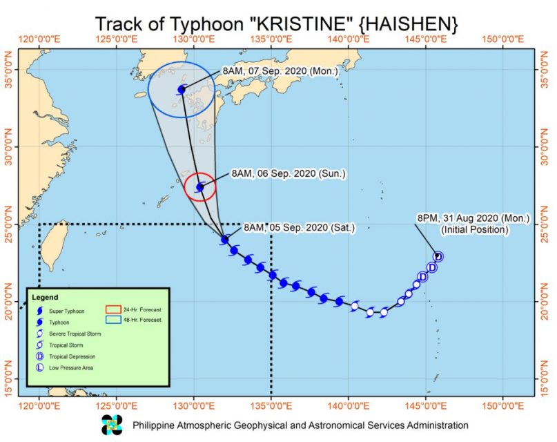
(Eagle News) — Typhoon Haishen, with local name “Kristine,” slightly weakened as it continues to move northwestward on Saturday, Sept. 5, the country’s weather bureau said.
The Philippine Atmospheric and Geophysical Services Administration (PAGASA) said that Haisen will continue “moving northwestward until it exits the Philippine Area of Responsibility (PAR) tonight.”
“It is then expected to turn north-northwestward beginning tonight and pass close to Northern Amami Islands and Tokara Islands in the Ryukyu Archipelago (Japan) between tomorrow noon and evening. Afterwards, the typhoon will head towards the sea off the west coast of Kyushu (Japan) and the Korean Peninsula,” the PAGASA bulletin issued at 11 a.m. Saturday, Sept. 5, said.
“This typhoon is forecast to maintain its current intensity within the next 24 to 36 hours before gradually weakening while moving closer towards mainland Japan. However, a slight intensification to 195-205 km/h within the next 24 to 36 hours remains a possibility,” it said.
PAGASA said that the typhoon is “unlikely to directly affect the weather condition in the country throughout the forecast period.”
As of 10 a.m. today, the eye of the typhoon was located based on all available data at 1,080 km East Northeast of Extreme Northern Luzon (24.1 °N, 131.7 °E )
It is moving Northwestward at 15 km/h, with maximum sustained winds of 185 km/h near the center and gustiness of up to 230 km/h, PAGASA said.
“Gale Warning is in effect for the seaboards of Batanes and Cagayan (including Babuyan Islands) due to rough to very rough seas (2.8 to 4.5 m). Sea travel is risky over these areas,” it said.
“Moderate to rough seas (1.2 to 2.8 m) will be experienced over the eastern seaboards of Luzon (except for areas under Gale Warning) and Visayas. Those with small seacrafts are advised to take precaution while venturing out to sea,” it added.
(Eagle News Service)


