


Signal no. 1 raised in several areas in Luzon, Visayas and Mindanao
(Eagle News) – Tropical depression “Lannie” is now over the Surigao Strait and about to make landfall in the vicinity of southern Leyte, according to the country’s weather bureau, PAGASA.
PAGASA has also raised tropical cyclone wind signal no. 1 in several areas in Luzon, Visayas and Mindanao due to Lannie’s expanse in its 8 a.m. weather bulletin.
It has already made two landfalls so far: in Bucas Grande Island, Socorro, Surigao del Norte at 4:30 a.m; and Cagdianao, Dinagat Islands at 5:00 a.m.
-Areas in Luzon, Visayas, Mindanao under Signal no. 1-
Here are the areas in the country under Signal no. 1:
Luzon
The southern portion of Masbate (Pio V. Corpuz, Cataingan, Palanas, Dimasalang, Uson, Mobo, Milagros, Mandaon, Esperanza, Placer, Cawayan, Balud), the southern portion of Romblon (Cajidiocan, San Fernando, Magdiwang, Santa Maria, Odiongan, Alcantara, Ferrol, Looc, Santa Fe, San Jose), the southern portion of Oriental Mindoro (Roxas, Mansalay, Bulalacao, Bongabong), the southern portion of Occidental Mindoro (Sablayan, Calintaan, Rizal, San Jose, Magsaysay), and the northern portion of Palawan (El Nido, Taytay, Dumaran, Araceli) including Calamian and Cuyo Islands.
Visayas
Eastern Samar, Samar, Biliran, Leyte, Southern Leyte, Capiz, Aklan, Antique, Iloilo, Guimaras, Negros Occidental, the northern and central portions of Negros Oriental (Bais City, Mabinay, City of Bayawan, Basay, City of Tanjay, Manjuyod, Bindoy, Ayungon, Tayasan, Jimalalud, La Libertad, City of Guihulngan, Vallehermoso, Canlaon City), Cebu, and Bohol
Mindanao
Surigao del Norte, Dinagat Islands, the northern portion of Agusan del Norte (Magallanes, Remedios T. Romualdez, City of Cabadbaran, Tubay, Santiago, Jabonga, Kitcharao, Butuan City), the northern portion of Agusan del Sur (Sibagat, City of Bayugan, Prosperidad), and the northern portion of Surigao del Sur (San Miguel, Marihatag, San Agustin, Cagwait, Bayabas, Tago, City of Tandag, Cortes, Lanuza, Carmen, Madrid, Cantilan, Carrascal, Lianga)
-Location of TD Lannie-
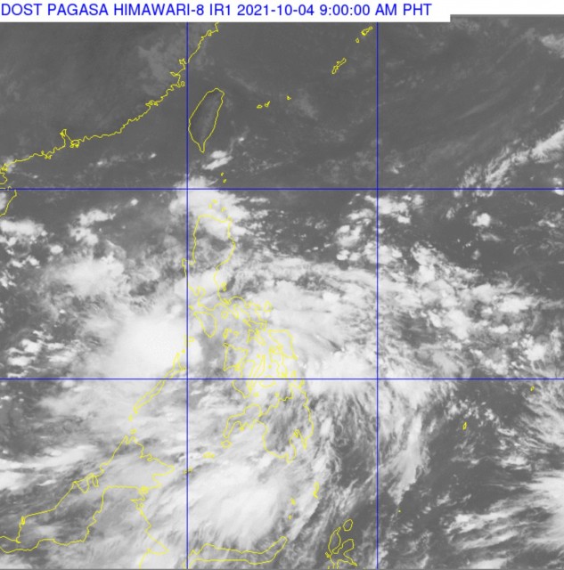
PAGASA said that the center of Tropical Depression “LANNIE” was estimated based on all available data over the coastal waters of Liloan, Southern Leyte (10.1°N, 125.3°E).
It has maximum sustained winds of 45 km/h near the center, gustiness of up to 55 km/h, and central pressure of 1002 hPa. It is moving west northwestward at 15 km/h.
PAGASA forecasts moderate to heavy with at times intense rains over the Visayas, Bicol Region, MIMAROPA, CALABARZON, and Caraga Region today, Monday, Oct. 4, through tomorrow morning. Light to moderate with at times heavy rains are also possible over Metro Manila, Bulacan, Bataan, and the rest of Mindanao.
Strong winds (strong breeze to near gale conditions) with occasional gusts will be experienced within any of the areas where Tropical Cyclone Wind Signal #1 is in effect during the passage of the tropical depression, the weather bureau said.
“On the forecast track, the tropical depression will move generally west northwestward over the Visayas archipelago until tonight or tomorrow early morning, when it is expected to emerge over the Sulu Sea and cross the Cuyo archipelago,” PAGASA said.
-Another landfall expected in Northern Palawan, Calamian-
“Afterwards, the depression may make another landfall in the vicinity of northern Palawan or Calamian Islands tomorrow morning before emerging over the West Philippine Sea a couple of hours later,” it said.
Throughout this entire period, “LANNIE” is forecast to remain within tropical depression category, with a possibility of slight intensification once over the Sulu Sea or West Philippine Sea.
By late Tuesday through early Thursday, “LANNIE” is forecast to move generally northwestward over the West Philippine Sea. Improvement in environmental conditions will allow the depression to intensify. It may likely be upgraded into a tropical storm by Wednesday early morning.
It is forecast to exit the Philippine Area of Responsibility (PAR) on Thursday morning. Outside the PAR, the cyclone is forecast to turn more north northwestward while heading towards southern mainland China. It will continue intensifying during this period and may reach severe tropical storm category by Saturday morning, PAGASA added.
(Eagle News Service)


