


(Eagle News) — Tropical storm “ROLLY” (international name Goni) is “no longer affecting the country” as it moves to exit the Philippine Area of Responsibility (PAR) this morning, Tuesday, Nov. 3, according to the country’s weather bureau, PAGASA.
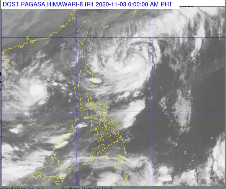
At 3 a.m. today, the center of Tropical Storm ROLLY {GONI} was estimated based on all available data at 450 km West of Iba, Zambales (15.0°N, 115.8°E) with maximum sustained winds of 65 km/h near the center and gustiness of up to 80 km/h.
It is moving Westward at 15 km/h towards the western limits of PAR.
Meanwhile, the center of Tropical Storm SIONY {ATSANI} was estimated based on all available data at 595 km East of Calayan, Cagayan (19.8°N, 127.1°E) with maximum sustained winds of 75 km/h near the center and gustiness of up to 80 km/h. It remains almost stationary. There is a northeasterly Surface Windflow affecting Northern Luzon.
PAGASA said that the the northeasterlies enhanced by Tropical Storms “ROLLY” and “SIONY” will bring strong to near gale conditions with higher gusts over Batanes, Babuyan Islands, and the northern portions of Cagayan and Ilocos Norte.
The two storms’ combined effects and the enhanced northeasterlies will bring rough to very rough seas (2.8 to 4.5 m) over the entire seaboards of Northern Luzon and the western seaboard of Central Luzon. Sea travel is risky over these waters, especially for those using small seacrafts, PAGASA’s 11 p.m. bulletin issued Monday night said.
“Moderate to rough seas (1.5 to 2.5 m) will be experienced over the remaining seaboards of Luzon and the eastern seaboards of Visayas and Mindanao. Mariners of small seacrafts are advised to take precautionary measures when venturing out to sea. Inexperienced mariners should avoid navigating in these conditions,” it added.
(Eagle News Service)


