


(Eagle News) – Tropical storm “Dante” (international name Choi-wan) has left the country, but could re-enter this afternoon before heading straight to Taiwan where it is forecast to landfall tonight
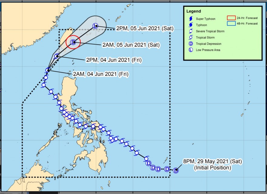
In its latest advisory at 5 a.m., the country’s weather bureau PAGASA said that “Dante” as of 4 a.m. is already outside the Philippine Area of Responsibility (PAR). It was estimated at 285 kilometers northwest of Laoag City, Ilocos Norte. The storm made its exit from the Philippines at 2 a.m. Friday, June 4.
It is forecast to move generally north northeastward or northeastward throughout the forecast period.
But PAGASA said that based on the storm’s forecast track, “its center will re-enter the PAR this afternoon and make a close approach or landfall in the vicinity of southern Taiwan (i.e., Pingtung County area) tonight.”
“Afterwards, the storm will continue moving northeastward towards the East China Sea,” the bureau said.
“Dante” has maximum sustained winds of 65 km/h near the center, gustiness up to 80 km/h, and central pressure of 998 hPa.
PAGASA said a gale warning is still in effect over the northern and western seaboards of Northern Luzon (2.5 to 4.5 m) due to rough to very rough seas. “Sea travel is risky for small seacrafts over these waters,” the weather bureau said.
(Eagle News Service)


