


But warns of rough seas in northern and eastern seaboards of Luzon
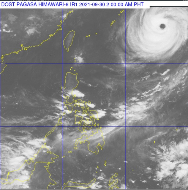
(Eagle News) – The powerful typhoon Mindulle, with gusts of up to 215 kilometers per hour, “is no longer expected to enter PAR” or the Philippine Area of Responsibility, according to the country’s weather bureau, PAGASA.
In its latest advisory, PAGASA said that “this typhoon is unlikely to directly affect the weather condition in the country,” but warned of “rough seas due to swells caused by the typhoon” in the northern and eastern seaboards of Luzon. PAGASA advises the situation will be risky for small seacrafts.
“Mariners are advised to take precautionary measures when venturing out to sea and, if possible, avoid navigating in these conditions,” PAGASA said.
Typhoon Mindullee has maximum sustained winds of 175 km/h near the center and gustiness up to 215 km/h. It has a central pressure of 935 hPa, and moving north northwestward at 15 km/h.
PAGASA forecasts that this typhoon will be 1,615 km East Northeast of Extreme Northern Luzon, or still outside the Philippine Area of Responsibility (PAR) by 8 a.m. Thursday, Sept. 30.
It is expected to further move away, and be 1,880 km East Northeast of Extreme Northern Luzon by 8 p.m.
PAGASA has been monitoring this past tropical cyclone the past few days as it is feared to enter the country.
(Eagle News Service)


