


(Eagle News) – Tropical cyclone “Dante” which exited the country early Friday, June 4, re-entered the Philippine Area of Responsibility (PAR) , and is now affecting Batanes which is under signal number 1.
Batanes will be experiencing “strong winds” during the passage of Dante, PAGASA said in its 5 p.m. bulletin.
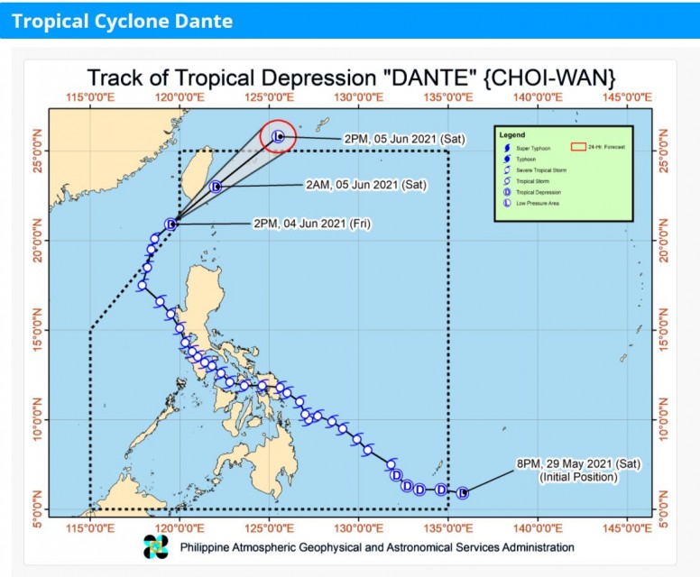
The center of Tropical Depression “DANTE” (CHOIWAN) was estimated based on all available data 210 kilometers West Northwest of Basco, Batanes or 185 km West of Itbayat, Batanes (21.1°N, 120.1°E). It has maximum sustained winds of 55 km/h near the center, gustiness up to 70 km/h, and central pressure of 1000 hPa. It is moving northeastward at 20 km/h.
After leaving the country early today, “Dante” weakened into a tropical depression. It exited the country at 2 a.m., as a tropical storm. It became a tropical depression at 2 p.m. and “re-entered” the country at 4 p.m. Friday. It is forecast to move northeastward, and will make a “close approach or landfall in the vicinity of southern Taiwan tonight).
PAGASA said that it “will continue moving northeastward towards East China Sea and will leave the PAR (Philippine Area of Responsibility) tomorrow afternoon” Saturday, June 5, at around 2 p.m.
(Eagle News Service)


