


(Eagle News) – Tropical Storm “Ramon” has slightly slowed down as it moved west-northwestward, as the country’s weather bureau raised tropical cyclone wind signal number 2 in Catanduanes, while signal number 1 is in effect over more areas in Luzon and Visayas.
PAGASA said that “between today and tomorrow afternoon, light to moderate with occasional heavy rains may be experienced over eastern portion Cagayan and Isabela, Camarines Norte, Camarines Sur, and Catanduanes.”
“Light to moderate with intermittent heavy rains” will also be experienced over Apayao, Aurora, Quezon, and the rest of Cagayan, Isabela, and Bicol Region, it said.
Tropical Cyclone Wind Signal No. 1 has been raised over Camarines Norte, Camarines Sur, Albay and Sorsogon in Luzon, and over Eastern Samar and Northern Samar in the Visayas.
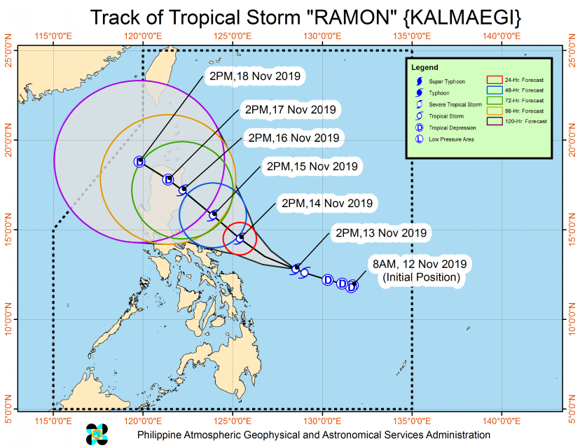
As of 4:00 PM Wednesday, Nov. 13, the center of tropical storm “Ramon” was estimated based on all available data at 390 km East of Catarman, Northern Samar (12.9 °N, 128.2 °E ).
Ramon is moving west northwest at 10 kilometers per hour, with maximum sustained winds of 65 kph near the center and gustiness of up to 80 kph. In a previous advisory, Ramon was moving at 20 kph.
It is forecast to be 160 km Northeast of Virac, Catanduanes(14.5°N, 125.4°E) by Thursday afternoon, Nov. 13.
There is no indication yet that the storm Ramon will leave the country.
PAGASA said that it still might be here in the country, specifically 105 km Northwest of Laoag City, Ilocos Norte(18.8°N, 119.8°E) by Monday afternoon.


