


Rolly (Goni) forecast to weaken further into a tropical depression
(Eagle News) — ROLLY” (Goni) rapidly weakens into a tropical storm as another storm “Siony” (Atsani) which has earlier entered the Philippine Area of Responsibility (PAR) slightly weakened while moving over the Philippine Sea.
In Sunday’s 11 p.m. bulletin and today’s 4 a.m. bulletin of PAGASA, it said “ROLLY” is expected to exit the country on Tuesday morning. It is even forecast to further weaken ito a tropical depression “due to increasingly unfavorable conditions.”
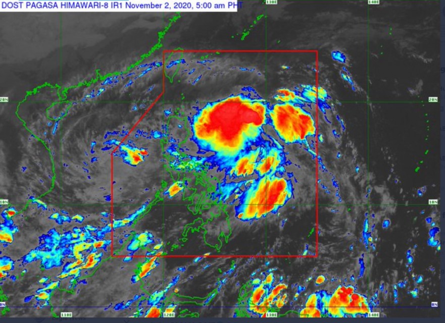
At 4:00 AM Monday, Nov. 2, the center of Tropical Storm “ROLLY” was estimated based on all available data at 100 km West Southwest of Subic Bay (14.6 °N, 119.4 °E ), PAGASA said. Rolly is moving West Northwestward at 20 km/h, with maximum sustained winds of 65 km/h near the center and gustiness of up to 80 km/h.
The center of Storm “Siony,” on the other hand, was estimated based on all available data at 990 km East of Northern Luzon (17.0 °N, 131.0 °E ) at 10 p.m., Sunday, Nov. 1. It was moving West Northwestward at 30 km/h with maximum sustained winds of 65 km/h near the center and gustiness of up to 80 km/h, the same speed as Rolly.
“Rolly” (Goni) was earlier described as the strongest typhoon to enter the Philippines this year with 225 km/h maximum sustained winds and gusts of up to 310 km/h as of 5 a.m. Sunday, Nov. 1 when it developed into a super typhoon and first made landfall over Bato, Catanduanes. With its intense winds early Sunday, it was comparable to the 2013 Super Typhoon Haiyan that killed more than 6,000 in Eastern Visayas. Within the day, however, it weakened until it became a tropical storm.
-Areas under Signal No. 1, including Metro Manila-
Only Tropical Cyclone Wind Signal No. 1 is up in the country over these areas: The northwestern portion of Occidental Mindoro (Paluan, Mamburao, Abra de Ilog) including Lubang Island, the western portion of Batangas (Tingloy, Mabini, Bauan, San Luis, Taal, Agoncillo, San Nicolas, Santa Teresita, Talisay, Laurel, Lemery, Calaca, Balayan, Calatagan, Tuy, Lian, Nasugbu), the extreme western portion of Laguna (San Pedro City, Biñan City), Cavite, Metro Manila, the western portion of Bulacan (San Jose del Monte City, Santa Maria, Pandi, Bustos, Baliuag, Marilao, Meycauayan City, Obando, Bocaue, Bulacan, Balagtas, Guiguinto, Pulilan, Plaridel, Malolos City, Paombong, Hagonoy, Calumpit), the western portion of Pampanga (San Luis, Mexico, Masantol, Sasmuan, Floridablanca, Lubao, Porac, Guagua, Santa Rita, Bacolor, Angeles City, Santo Tomas, San Fernando City, San Simon, Macabebe, Minalin, Apalit), Bataan, and the southern portion of Zambales (San Marcelino, San Felipe, San Narciso, San Antonio, Castillejos, Subic, Olongapo City).
PAGASA forecasts strong breeze to near gale conditions with occasional gusts for areas under TCWS #1, Batanes, Babuyan Islands, Ilocos Region, Cordillera Administrative Region, and the northern portions of mainland Cagayan and Zambales.
Rough to very rough seas (2.5 to 5.0 m) will prevail over the seaboards of Northern Luzon and Central Luzon, the western seaboards of Batangas, Occidental Mindoro including Burias Island, and Calamian Islands, and eastern seaboards of Quezon including Polillo Islands and Bicol Region. Sea travel is risky over these waters, especially for those using small seacrafts.
Moderate to rough seas (1.2 to 2.5 m) will be experienced over the western seaboards of Palawan including Kalayaan Islands and the eastern seaboards of Visayas and Mindanao. Mariners of small seacrafts are advised to take precautionary measures when venturing out to sea. Inexperienced mariners should avoid navigating in these conditions.
Meanwhile, PAGASA forecasts the center of Tropical Storm “SIONY” to continue moving west-northwestward and will become almost stationary this evening through Tuesday evening.
“Afterwards, “SIONY” will begin tracking west-southwestward or westward towards Extreme Northern Luzon. Due to the projected erratic movement of this system in the next 48 hours, there is high degree of uncertainty in the forecast track.”
It is likely remain within tropical storm category within the next 36 to 48 hours, PAGASA said in its 11 p.m. bulletin Sunday. “It may intensify to severe tropical storm category during the period when it becomes almost stationary on Tuesday.”
(Eagle News Service)


