
(Eagle News) – Typhoon Ineng (international name: Goni) has maintained its strength as it continued to move away from the country, and is forecast to be outside the Philippine Area of Responsibility (PAR) by Monday morning.
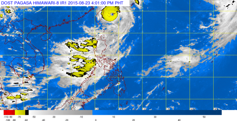
PAGASA said that as of 1 p.m. Sunday, Aug. 23, it was located 390 km northeast of Basco, Batanes. “Ineng” has maximum sustained winds of 140 kilometers per hour near the center and gustiness of up to 170 kph.
By morning of August 24, it is forecast to be 720 kilometers northeast of Basco, Batanes.
As of Sunday, the National Disaster Risk Reduction and Management Council (NDRRMC) said that the typhoon has left 14 people dead mostly from Mountain Province and the Ilocos Norte.
The NDRRMC has monitored 15 flooding incidents, nine landslides, five tornadoes and two river swellings.
It said a total of 7,470 families or 32,648 persons have been affected and evacuated due to the typhoon in Ilocos Region, Cagayan region, CALABARZON, and the Cordillera Administrative Region.
As of 3:50 p.m. Sunday, light to moderate with occasional heavy rains affect western Pangasinan, Nueva Vizcaya, and parts of Quirino which may persist for one to two hours.
Only the Batanes group of islands are still under public storm warning signal (number 1) with winds of 30 to 60 kilometers per hour as of Sunday 11 p.m.
PAGASA said that the enhanced “Habagat” will still bring monsoon rains over Metro Manila, CALABARZON, MIMAROPA, Ilocos region, CAR and the provinces of Zambales, Bataan and the islands of Calayan and Babuyan. These areas are alerted against possible flashfloods and landslides.
Fisher folk are also advised not to venture out over the seaboards of Luzon.


