


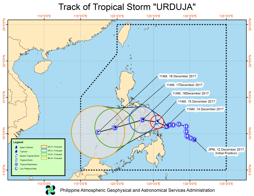
(Eagle News) — Tropical depression “Urduja” has slightly intensified and slowed down as it threatened Samar provinces, according to the country’s weather bureau, PAGASA.
As of 10 a.m., Thursday (December 14), the center of tropical depression “Urduja” was estimated based on all available data at 120 kilometers east of Guian, Eastern Samar. It has maximum sustained winds of up to 60 kilometers per hour near the center and gustiness of up to 80 kph, and forecast to move west at seven kilometers per hour.
It is forecast to be in the vicinity of Quinapondan, Eastern Samar by Friday morning, when it is expected to make landfall.
“Estimated rainfall amount is from moderate to heavy within the 400 km diameter of the Tropical Depression,” it said.
Scattered to widespread rains is expected over Visayas and the regions of Bicol, Caraga and Northern Mindanao within 24 hours. Residents in these areas are alerted against possible flashfloods and landslides.
PAGASA advised fisherfolks and those with small seacrafts not to venture out over the eastern seaboard of Bicol Region and Eastern Visayas.
This is due to moderate to rough seas associated with the approaching tropical depression “Urduja.”
Signal number 1 is hoisted over Catanduanes, Camarines Sur,Albay, Sorsogon, Masbate and Romblon in Luzon; and over Eastern Samar, Northern Samar, Samar, Biliran, Leyte, and Southern Leyte, Northern Cebu including Bantayan Island, Capiz, Aklan and Northern Iloilo in the Visayas region.
PAGASA said winds of 30 to 60 kilometers per hour are expected in these areas.


