

(Eagle News) — Tropical Depression Maring is now in the vicinity of Pampanga as it prepares to leave the landmass of Luzon tonight, according to the country’s weather bureau, PAGASA.
Forecasters said that “moderate to heavy rains will be experienced over Pampanga, Bulacan, Tarlac, Zambales, Bataan and Pangasinan.”
“Meanwhile, light to moderate with occasionally heavy rains during thunderstorms is expected over Metro Manila, the rest of Central Luzon, CALABARZON and MIMAROPA. Residents in these areas are alerted against possible landslide and flashfloods,” PAGASA’s latest forecast said.
Maring is “expected to leave the Luzon landmass tonight, and exit PAR (Philippine Area of Responsibility) tomorrow morning or Thursday early morning.”
PAGASA warned that sea travel remains “risky over the seaboards of Central Luzon, CALABARZON and Mindoro.”
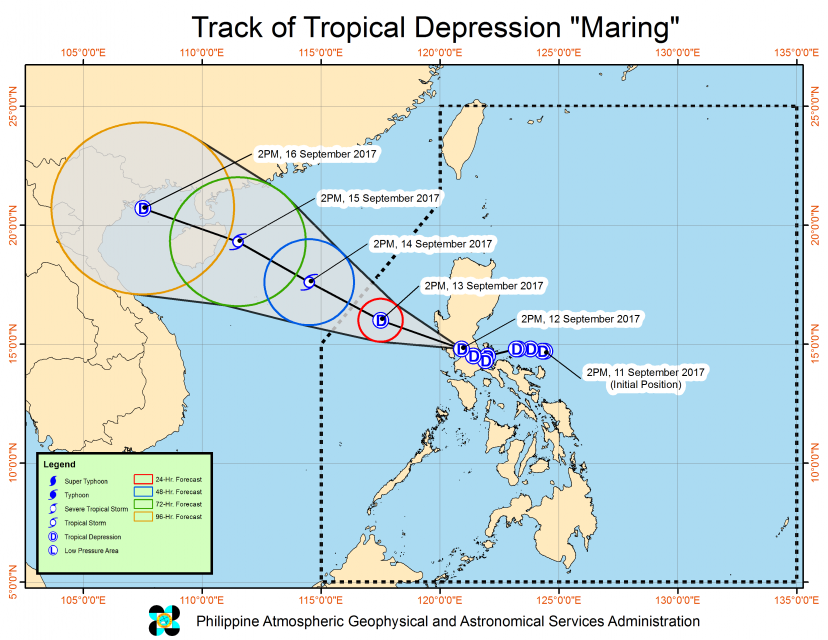
Maring has maximum sustained winds of 60 kilometers per hour (kph) near the center and gustiness of up to 100 kph.
It is forecast to move West Northwest at 15 kph.
By Wednesday afternoon, Sept. 13, it is expected to be 280 km West Northwest of Iba, Zambales(16.0°N, 117.5°E).
And by Thursday afternoon, Sept. 14, it is forecast to be 640 km West Northwest of Iba, Zambales, or outside the Philippines.
As of 5 p.m., Tuesday, September 12, the following area are still under public storm warning signal number 1: Metro Manila, Cavite, Laguna, Batangas, Rizal, Northern Quezon including Polillo island, Southern Aurora, Bulacan, Pampanga, Nueva Ecija, Tarlac, Zambales, Bataan and Pangasinan.


