
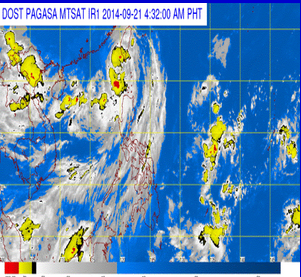
MANILA, Philippines (ENS) — Tropical Storm “MARIO” has maintained its strength as it continues to move closer to Southern Taiwan, according to the country’s weather bureau, PAGASA.
Most of the storm warning signals in the country were lowered as of 4 a.m., Sunday morning as “Mario” was located at 155 kilometers northwest of Itbayat, Batanes. It is forecast to move north northeast at 17 kilometers per hour.
Only the Batanes group of islands is placed under storm signal number two, while Calayan and the Babuyan group of islands, and Ilocos Norte were under storm signal number one.
By Monday morning, it is forecast to be 518 kilometers north northwest of Itbayat, Batanes or at the northern tip of Taiwan. By Tuesday morning, it is forecast to be outside the Philippine Area of Responsibility (PAR)
Estimated rainfall amount is from 7 – 15 mm per hour (moderate – heavy) within the 450 km diameter of the Tropical Storm.
Meanwhile, the provinces of Ilocos Sur, La Union, Pangasinan, Benguet, Zambales and Bataan will experience monsoon rains with moderate to occasionally strong winds due to the combined effect of Southwest Monsoon and TS “MARIO.”
Fisherfolks and those with small seacrafts are advised not to venture out into the seaboards of Northern and Central Luzon. (ENS)


