


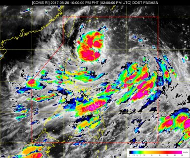
(Eagle News) — “Isang” intensified into a Tropical Storm on Sunday, as it continued to move westward and brought rains in parts of the country.
In an 11 p.m. weather bulletin, the Philippine Atmospheric and Geophysical Astronomical Services Administration said as of 10 p.m., the eye of “Isang” was at 485 kilometers east of Basco, Batanes, bringing maximum sustained winds of up to 65 kilometers per hour near the center and gustiness of up to 80 kph.
Moderate to occasionally heavy rains are expected in areas within 300 kilometers of the Tropical Storm, with Signal Number One being hoisted over the Batanes Group of Islands and the Babuyan Group of Islands.
“Isang” is expected to move west at 17 kph.
In 24 hours, Pagasa said it is expected to be 130 kilometers northeast of Basco, Batanes; in 48 hours or on Tuesday evening, it is expected to be outside of the Philippine Area of Responsibility, 445 kilometers northwest of Basco, Batanes.


