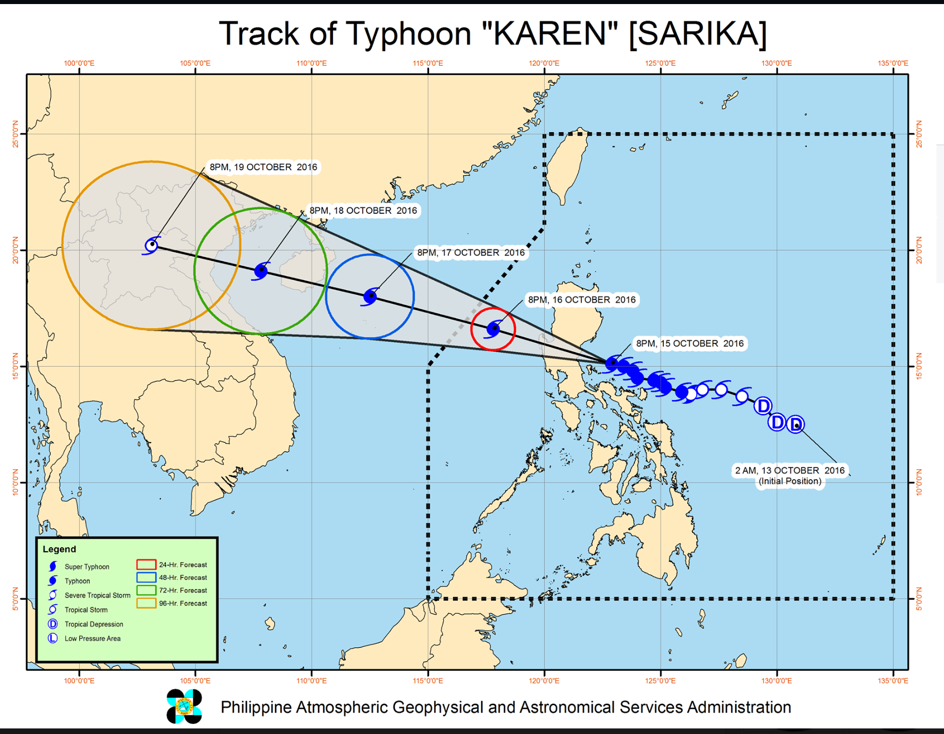

(Eagle News) — Ten provinces have been placed under Signal number 3 as typhoon “Karen,” international name Sarika, further intensified as it continued to threaten the province of Aurora.
The typhoon is expected to pass close to Polillo Islands tonight and make landfall over Aurora early Sunday morning (October 16).
The provinces placed under public storm warning signal number three are: Pangasinan, Northern Zambales, Tarlac, Nueva Ecija, Aurora, Northern Quezon including Polilio Island, La Union, Benguet, Nueva Vizcaya and Quirino.
These areas are expected to experience winds of 121 to 170 kilometers per hour in the next 18 hours at least.
The estimated rainfall is from moderate to heavy within the 500 kilometer diameter of the typhoon
PAGASA, the country’s weather bureau, warned that storm surges could occur along the coastal communities of the areas placed under signal number three.
As of 10 p.m., Saturday, October 15, the eye of typhoon “Karen” was located at 120 kilometers east northeast of Infanta, Quezon with maximum sustained winds of 150 kilometers per hour near the center and gustiness of up to 120 kph. It is forecast to move west northwest at 22 kph.
Malacanang asks public to prepare for “Karen”
Malacanang has urged the public to prepare for typhoon Karen which is said to be the most damaging typhoon so far this year.
“Please, maghanda po tayo dahil ang Karen, iyong 11th na typhoon na papasok sa ating bayan this year, ay scheduled to make landfall sa Aurora o Quezon bukas po ng umaga,” Presidential spokesman Secretary Ernesto Abella said in a radio interview.
Those placed under storm signal number 2 are Ilocos Sur, Southern Isabela, Mt Province, Ifugao, Rest of Zambales, Pampanga, Bulacan, Bataan, Rizal, Metro Manila, Rest of Quezon and Camarines Norte. They are expected to experience winds of 61 to 120 kph in the next 24 hours.
The areas under storm signal number 1 are: Ilocos Norte, Abra, Kalinga, Rest of Isabela, Southern Apayao, Southern Cagayan, Oriental Mindoro, Cavite, Batangas, Laguna, Marinduque, Camarines Sur, Catanduanes, Albay and Burias Island. They will be experiecing winds of 30 to 60 kph in the next 36 hours.
Typhoon Karen is expected to exit the landmass of the country via Pangasinan by Sunday afternoon. It is forecast to be outside of the Philippine Area of Responsibility (PAR) by Monday evening (October 17)
Preemptive evacuation ordered
Pangasinan Governor Amado Espino III has called on his provincemates living in danger zones prone to landslides, flashfloods and storm surges, to evacuate their homes before the typhoon unleashes its fury.
The Pampanga Provincial Disaster Risk Reduction and Management Office (PDRRMO) likewise ordered on Saturday a preemptive evacuation of residents living in the coastal and landslide prone areas in the province in connection with the possible onslaught of typhoon ‘Karen.’
The PDRRMO directed the Municipal Disaster Risk Reduction and Management Councils in the coastal towns of of Lubao, Sasmuan, Macabebe and Macabebe to implement preemptive evacuation for possible occurence of storm surge.
The PDRRMO also urged residents in the upland barangays of Arayat, Floridablanca, Magalang, and Porac to evacuate due to possible landslides.
“The implementation of preemptive evacuation is necessary to avoid injuries and loss of lives,” Angie Blanco, head of the PDRRMO, said. (Eagle News Service, with reports from PNA)
