


MANILA, Philippines (Eagle News Service) — Typhoon Ruby is expected to make landfall on Saturday evening or Sunday morning over the Eastern Samar-Northern Samar area according to the country’s weather bureau which warned of strong winds and storm surges of up to four meters with heavy to intense rainfall that the typhoon would cause.
Based on PAGASA’s 11 p.m. severe weather bulletin, it said Typhoon Ruby is expected to bring in an estimated rainfall amount of 7.5 – 20 mm per hour (heavy – intense) within the 600 km diameter of the typhoon.
PAGASA has already placed under storm warning signal number 3 the areas of Samar, particularly Northern and Eastern Samar.
It also placed five provinces of Luzon, particularly Catanduanes, Albay, Sorsogon, Ticao Island and Masbate under storm signal number two. Seven more areas from the Visayas region were also placed under storm signal number two. These are Biliran, Leyte, Southern Leyte, Northern Cebu, including Cebu City, Bantayan Island and Camotes Island, all of which were also severely hit by supertyphoon Yolanda in November last year. Dinagat province in Mindanao was also placed under storm signal number two.
At least 20 more provinces across the country – from Luzon, Vayas and Mindanao — had been placed under storm warning signal number 1 because of typhoon Ruby. These are Camarines Norte, Camarines Sur, Burias Island, Romblon, southern Quezon and Marinduque in Luzon; Capiz, Iloilo, Antique, Guimaras, Aklan, Negros Oriental, Negros Occidental, the rest of Cebu, and Bohol in the Visayas region; and Surigao del Sur, Surigao del Norte, Agusan del Norte, Siargao Island, Agusan del Sur and Camiguin Island in Mindanao.
“Residents in low lying and mountainous areas are alerted against flashfloods and landslides. Likewise, those living along the coast are warned on the occurrence of big waves associated with storm surges which may reach up to 4 meters,” PAGASA’s 11 p.m. weather bulletin said.
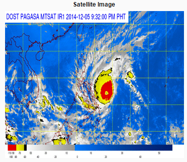
Typhoon Ruby, with maximum sustained winds of 195 kph near the center and gustiness of up to 230 kph, has a diameter of 600 kilometers, thus affecting at least 36 areas and provinces from Luzon down to Mindanao.
“Typhoon Ruby and the Northeast Monsoon will bring rough to very rough sea conditions over the seaboards of Northern Luzon, eastern seaboard of Central and Southern Luzon, seaboards of Visayas and over northern and eastern seaboards of Mindanao. Fisherfolks and those using small seacraft are advised not to venture out over the said seaboards,” PAGASA said.

As of 2 a.m., the typhoon was located 270 kilometers east northeast of Borongan, Eastern Samar. Even as it packed strong winds of 195 kph, it is however moving at a slow pace of 10 kilometers per hour. Because of this, PAGASA forecasts the typhoon to exit the Philippine area of responsibility on Wednesday, Dec. 10. It warned all residents in the provinces and areas in typhoon Ruby’s path to brace themselves for very strong winds and heavy rains that this typhoon would bring.
PAGASA said typhoon Ruby is expected to be 85 km Northeast of Borongan, Eastern Samar or at 170 km East Southeast of Catarman, Northern Samar by Saturday evening. It is forecast to be 75 km Northwest of of Masbate City, Masbate by Sunday evening, and 150 km West of Calapan City, Oriental Mindoro by Monday evening.


