


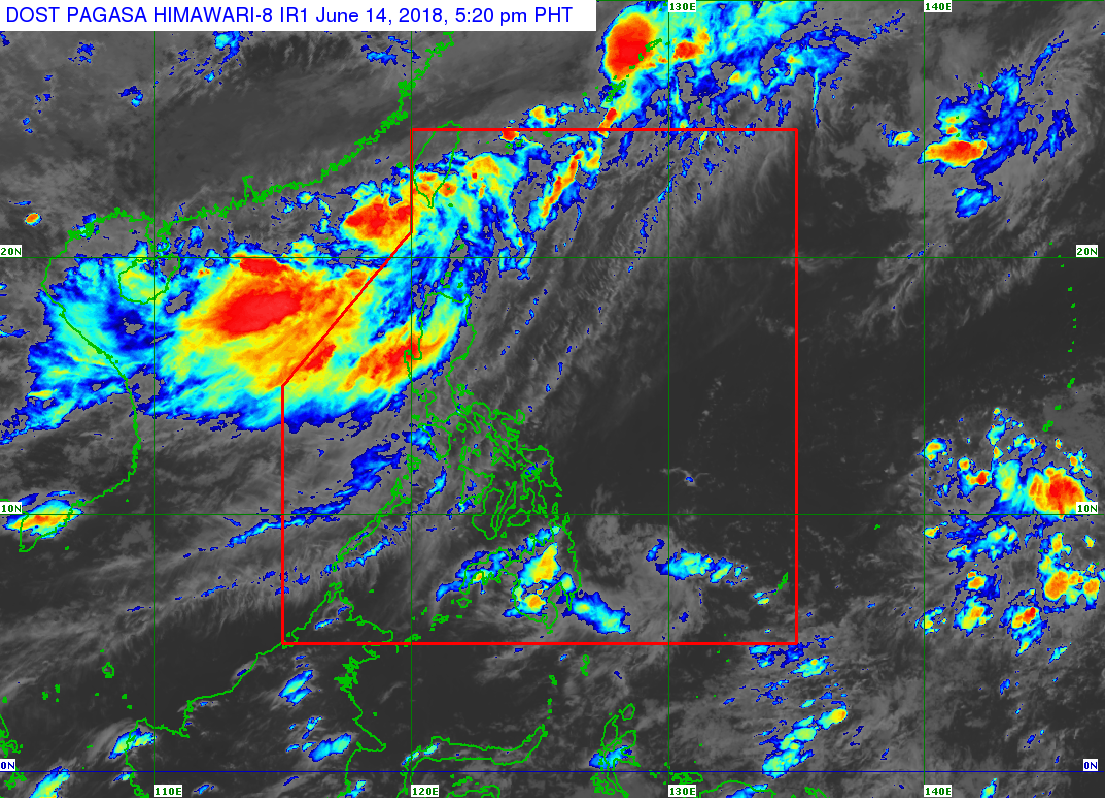
(Eagle News) — The low pressure area found west northwest of Batanes has developed into a tropical depression, and is expected to enter the Philippine area of responsibility between Thursday night and Friday morning.
Once it enters PAR, the Philippine Atmospheric Geophysical and Astronomical Services Administration said it will be named Ester.
According to Pagasa, occasional rains with gusty winds will prevail over Batanes as the weather disturbance approaches, and is expected to make landfall over southern Taiwan “between tonight and tomorrow morning.”
The tropical depression is also expected to enhance the southwest monsoon, and will therefore bring moderate to occasional heavy rains over Ilocos Region, Cordillera Administrative Region, Zambales and Bataan, and light to moderate with at times heavy rains over Metro Manila, Tarlac, Pampanga, Bulacan, Cavite and Batangas until the weekend, Pagasa said.
“Residents of the aforementioned areas, especially those living near or in low-lying and mountainous areas, are advised to take appropriate actions against possible floodings and landslides, coordinate with local disaster risk reduction and management offices, and continue monitoring for updates,” Pagasa said.
It noted that sea travel was “risky over the seaboards of Northern Luzon and the western seaboard of Central Luzon.”


