


(Eagle News) – The country’s weather bureau has placed Catanduanes under tropical cyclone warning signal number one after supertyphoon “Ompong” (international name: Mangkhut) entered the country Wednesday afternoon, Sept. 12.
“Ompong” has maximum sustained winds of up to 205 kilometers per hour near the center and gusts of up to 255 kph.
It is expected to further intensify as it moves nearer Luzon. PAGASA warned that Ompong could have windspeeds comparable to those of supertyphoon Yolanda that hit the country in November 2013.
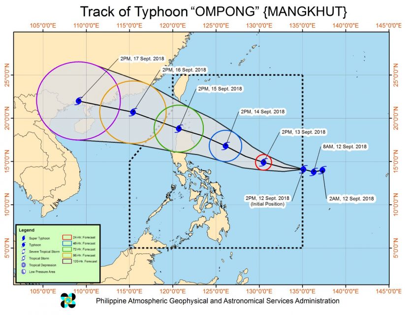
As of 4:00 p.m. Wednesday, the eye of Typhoon “Ompong” was located based on all available data at 1,145 km East of Virac, Catanduanes (14.0 °N, 134.8 °E ). It is moving west ay 20 kph.
Typhoon Ompong entered the Philippine Area of Responsibility (PAR) at 3:00 p.m. Wednesday afternoon and continues to threaten Northern Luzon.
Catanduanes, which is under signal number one, will already experience the peripheral effects of Ompong within the next 36 hours, bringing occasional rains and gusty winds, PAGASA said.
The typhoon could also reach a peak intensity of 220 kph in maximum winds and gusts of up to 270 kph tomorrow, Thursday, Sept. 13.
It is expected to make landfall in the northern tip of Cagayan on Saturday, Sept. 15.
Storm warning signal number one may also “be raised in provinces of Cagayan, Isabela, Aurora, Camarines Norte and Camarines Sur tomorrow morning, Sept. 15.


